Approximate Location Map
Large Map »
Latitude: 51.4803 / 51°28'48"N
Longitude: -1.6182 / 1°37'5"W
OS Eastings: 426611
OS Northings: 175769
OS Grid: SU266757
Mapcode National: GBR 5XY.5PM
Mapcode Global: VHC1J.W2W2
Plus Code: 9C3WF9JJ+4P
Entry Name: 12 Oxford Street
Listing Date: 6 March 1985
Grade: II
Source: Historic England
Source ID: 1365428
English Heritage Legacy ID: 310517
ID on this website: 101365428
Location: Aldbourne, Wiltshire, SN8
County: Wiltshire
Civil Parish: Aldbourne
Built-Up Area: Aldbourne
Traditional County: Wiltshire
Lieutenancy Area (Ceremonial County): Wiltshire
Tagged with: Building
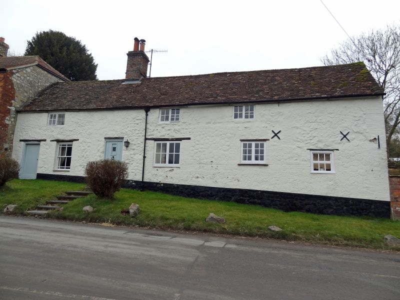
ALDBOURNE OXFORD STREET (south east side)
SU 27 NE 9/57
No 12
II
Farmhouse, now house. C17-C18. Colourwashed rubble with tiled roof. 1-storey and attic, 4 bays, the first bay left is an extension beyond brick quoininq. Entrance in second bay opposite 4-flued stack. Entrance to right bays removed. Boarded doors, timber casement windows but margin glazed sash to first bay. Small 4-pane casement to first floor.
Listing NGR: SU2661175769
External links are from the relevant listing authority and, where applicable, Wikidata. Wikidata IDs may be related buildings as well as this specific building. If you want to add or update a link, you will need to do so by editing the Wikidata entry.


Other nearby listed buildings
