Approximate Location Map
Large Map »
Latitude: 51.3507 / 51°21'2"N
Longitude: -1.6157 / 1°36'56"W
OS Eastings: 426861
OS Northings: 161358
OS Grid: SU268613
Mapcode National: GBR 5ZJ.6CB
Mapcode Global: VHC23.Y97X
Plus Code: 9C3W992M+7P
Entry Name: Hollow Lane Cottage
Listing Date: 30 July 1986
Grade: II
Source: Historic England
Source ID: 1365485
English Heritage Legacy ID: 310762
ID on this website: 101365485
Location: Wilton, Wiltshire, SN8
County: Wiltshire
Civil Parish: Grafton
Traditional County: Wiltshire
Lieutenancy Area (Ceremonial County): Wiltshire
Tagged with: Cottage Thatched cottage
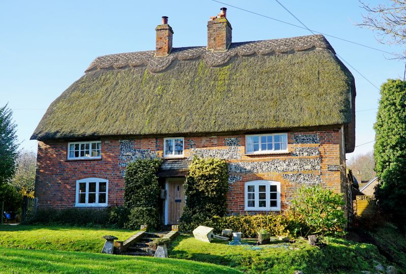
GRAFTON HOLLOW LANE, Wilton (south west side)
SU 26 SE 5/42
Hollow Lane Cottage
GV II
House, late C17. Brick laced flint, gables rebuilt in brick. Thatched roof. Two-storey, 3 bays gable to street. Central boarded door leading to stair between stacks. Three-light
casements to ground floor, various windows above and 2 small blocked windows over door. Thatch half-hipped. C20 extensions to rear as conservatory, and to north west along road.
Listing NGR: SU2686161358
External links are from the relevant listing authority and, where applicable, Wikidata. Wikidata IDs may be related buildings as well as this specific building. If you want to add or update a link, you will need to do so by editing the Wikidata entry.


Other nearby listed buildings
