Approximate Location Map
Large Map »
Latitude: 51.3858 / 51°23'9"N
Longitude: -2.0541 / 2°3'14"W
OS Eastings: 396332
OS Northings: 165201
OS Grid: ST963652
Mapcode National: GBR 2TK.3HN
Mapcode Global: VHB47.BFYG
Plus Code: 9C3V9WPW+89
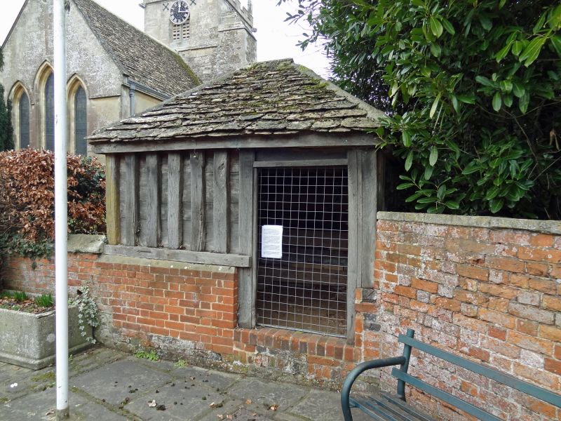
Entry Name: The Lock Up
Listing Date: 19 March 1962
Last Amended: 3 April 1987
Grade: II
Source: Historic England
Source ID: 1365574
English Heritage Legacy ID: 311190
ID on this website: 101365574
Location: St Nicholas's Church, Bromham, Wiltshire, SN15
County: Wiltshire
Civil Parish: Bromham
Built-Up Area: Bromham
Traditional County: Wiltshire
Lieutenancy Area (Ceremonial County): Wiltshire
Church of England Parish: Bromham, Chittoe and Sandy Lane
Church of England Diocese: Salisbury
Tagged with: Architectural structure
ST 9665 BROMHAM HIGH STREET
(west side)
10/40 The Lock-up
(Formerly listed as Old Lock-up in
19.3.62 Churchyard)
GV II
Lock-up, C18 possibly C17, timber-framed with stone slate pyramid
roof. Red brick base. Small, square plan with exposed studs,
boarded within and front door set high to right. South side door.
Listing NGR: ST9633365200
External links are from the relevant listing authority and, where applicable, Wikidata. Wikidata IDs may be related buildings as well as this specific building. If you want to add or update a link, you will need to do so by editing the Wikidata entry.


Other nearby listed buildings
