Approximate Location Map
Large Map »
Latitude: 54.4879 / 54°29'16"N
Longitude: -1.872 / 1°52'19"W
OS Eastings: 408392
OS Northings: 510290
OS Grid: NZ083102
Mapcode National: GBR HJCJ.JZ
Mapcode Global: WHC5Y.6GVC
Plus Code: 9C6WF4QH+56
Entry Name: Pant on Village Green
Listing Date: 28 October 1987
Grade: II
Source: Historic England
Source ID: 1365642
English Heritage Legacy ID: 111638
ID on this website: 101365642
Location: Barningham, County Durham, DL11
County: County Durham
Civil Parish: Barningham
Traditional County: Yorkshire
Lieutenancy Area (Ceremonial County): County Durham
Church of England Parish: Barningham St Michael and All Angels
Church of England Diocese: Leeds
Tagged with: Architectural structure
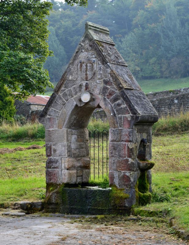
NZ 0810 BARNINGHAM BARNINGHAM VILLAGE
(South side)
15/49 Pant on
village green
GV II
Pant, dated 1866. Rough-faced stone with cut dressings; rock-faced-and-
margined slab coping. Open Gothic arch with carved keystone; datestone above
partly concealed by wrought-iron lamp bracket, under coped gable with moulded
footstones and finial. On each outer return is a domed niche holding a tap,
with a projecting moulded bowl beneath.
Listing NGR: NZ0839410288
External links are from the relevant listing authority and, where applicable, Wikidata. Wikidata IDs may be related buildings as well as this specific building. If you want to add or update a link, you will need to do so by editing the Wikidata entry.


Other nearby listed buildings
