Approximate Location Map
Large Map »
Latitude: 53.7827 / 53°46'57"N
Longitude: -1.0757 / 1°4'32"W
OS Eastings: 460998
OS Northings: 432211
OS Grid: SE609322
Mapcode National: GBR NSXP.XR
Mapcode Global: WHFD2.F5ZZ
Plus Code: 9C5WQWMF+3P
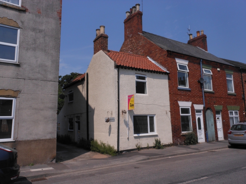
Entry Name: 122, Gowthorpe
Listing Date: 14 November 1980
Grade: II
Source: Historic England
Source ID: 1365810
English Heritage Legacy ID: 325774
ID on this website: 101365810
Location: Westfield, North Yorkshire, YO8
County: North Yorkshire
District: Selby
Civil Parish: Selby
Built-Up Area: Selby
Traditional County: Yorkshire
Lieutenancy Area (Ceremonial County): North Yorkshire
Church of England Parish: Selby St James
Church of England Diocese: York
Tagged with: Building
GOWTHORPE
1. (north side)
5342 ------------
No 122
SE 6032 SE 3/86
SE 6132 SW 4/86
II
2.
Probably early C19. Rendered. Pitched pantile roof. Two storeys. One bay to
front, one to side: Yorkshire casements with glazing bars. Side door with 6 sunk
panels.
Listing NGR: SE6099832211
External links are from the relevant listing authority and, where applicable, Wikidata. Wikidata IDs may be related buildings as well as this specific building. If you want to add or update a link, you will need to do so by editing the Wikidata entry.


Other nearby listed buildings
