Latitude: 52.2472 / 52°14'49"N
Longitude: 0.7134 / 0°42'48"E
OS Eastings: 585334
OS Northings: 264470
OS Grid: TL853644
Mapcode National: GBR QF0.15Z
Mapcode Global: VHKD4.BS05
Plus Code: 9F426PW7+V9
Entry Name: 10 and 11, Well Street
Listing Date: 12 July 1972
Grade: II
Source: Historic England
Source ID: 1365867
English Heritage Legacy ID: 467604
ID on this website: 101365867
Location: Bury St Edmunds, West Suffolk, IP33
County: Suffolk
District: West Suffolk
Civil Parish: Bury St Edmunds
Built-Up Area: Bury St Edmunds
Traditional County: Suffolk
Lieutenancy Area (Ceremonial County): Suffolk
Church of England Parish: Bury St Edmunds St John the Evangelist
Church of England Diocese: St.Edmundsbury and Ipswich
Tagged with: Building
BURY ST EDMUNDS
TL8564SW WELL STREET 639-1/7/646 (West side) 12/07/72 Nos.10 AND 11
GV II
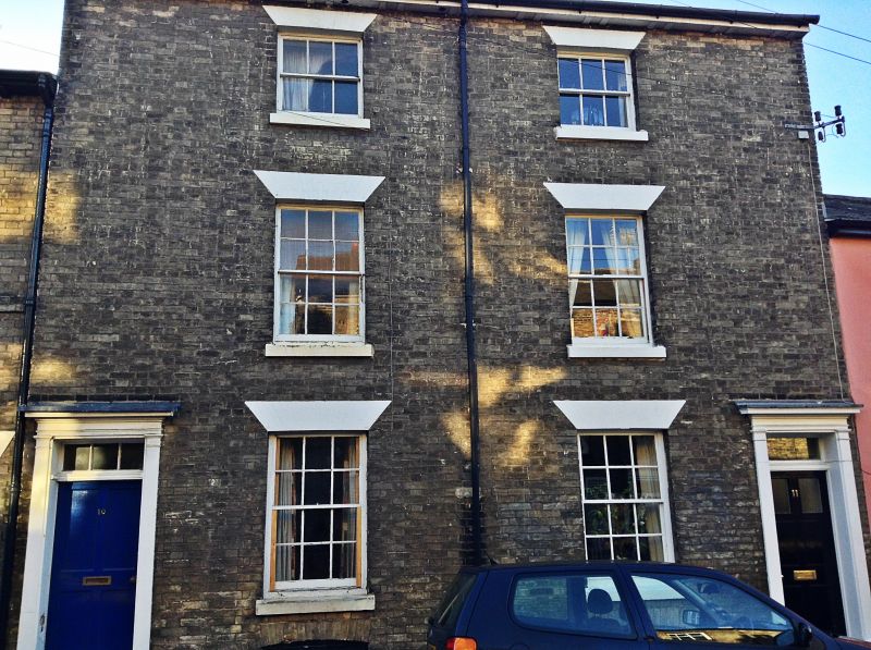
A pair of houses. Early C19. White brick front, rendered sides; slate roof with a paired mutule cornice. EXTERIOR: 3 storeys and cellars. 2 window range: 12-pane sashes to the ground and 1st storeys and 6-pane to the 2nd storey, all in deep reveals with wide flat painted arches and stone sills. Barred segmental headed cellar openings below the ground storey windows. An entrance door at each end of the front: half-glazed and 4-panel to No.10, a C20 replacement to No.11. Both have rectangular fanlights and wood doorcases with pilasters and cornice. INTERIOR: not inspected.
Listing NGR: TL8533464470
External links are from the relevant listing authority and, where applicable, Wikidata. Wikidata IDs may be related buildings as well as this specific building. If you want to add or update a link, you will need to do so by editing the Wikidata entry.


Other nearby listed buildings