Approximate Location Map
Large Map »
Latitude: 51.4563 / 51°27'22"N
Longitude: -2.5803 / 2°34'48"W
OS Eastings: 359778
OS Northings: 173196
OS Grid: ST597731
Mapcode National: GBR CCJ.CS
Mapcode Global: VH88N.7N8G
Plus Code: 9C3VFC49+GV
Entry Name: Entrance Gates, Wall and Drinking Fountain to Holy Trinity Almshouses
Listing Date: 4 March 1977
Grade: II
Source: Historic England
Source ID: 1366064
English Heritage Legacy ID: 380067
ID on this website: 101366064
Location: Newtown, Bristol, BS2
County: City of Bristol
Electoral Ward/Division: Lawrence Hill
Parish: Non Civil Parish
Built-Up Area: Bristol
Traditional County: Gloucestershire
Lieutenancy Area (Ceremonial County): Bristol
Church of England Parish: Bristol St Philip and St Jacob with Emmanuel
Church of England Diocese: Bristol
Tagged with: Gate
BRISTOL
ST5973SE OLD MARKET STREET, Old Market
901-1/12/1634 (South East side)
04/03/77 Entrance gates, wall and drinking
fountain to Holy Trinity Almshouses
GV II
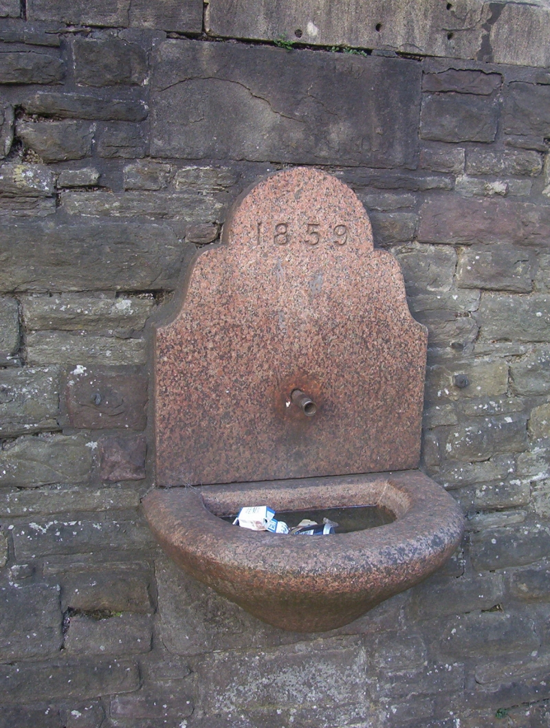
Entrance gates and wall. c1857. By Foster and Wood. Pennant
rubble with limestone dressings. Coped rubble wall with
wrought-iron railings on top with curved spikes, and similar
2-leaf gates to the entrance. SUBSIDIARY FEATURES: granite
basin and tap to drinking fountain on the corner with Midland
Road.
Listing NGR: ST5977873196
External links are from the relevant listing authority and, where applicable, Wikidata. Wikidata IDs may be related buildings as well as this specific building. If you want to add or update a link, you will need to do so by editing the Wikidata entry.


Other nearby listed buildings
