Latitude: 52.5807 / 52°34'50"N
Longitude: -2.7745 / 2°46'28"W
OS Eastings: 347616
OS Northings: 298382
OS Grid: SO476983
Mapcode National: GBR BH.BHM9
Mapcode Global: WH8CD.CD1D
Plus Code: 9C4VH6JG+76
Entry Name: Top Farmhouse
Listing Date: 7 April 1986
Grade: II
Source: Historic England
Source ID: 1366731
English Heritage Legacy ID: 259601
ID on this website: 101366731
Location: Leebotwood, Shropshire, SY6
County: Shropshire
Civil Parish: Leebotwood
Traditional County: Shropshire
Lieutenancy Area (Ceremonial County): Shropshire
Church of England Parish: Leebotwood
Church of England Diocese: Hereford
Tagged with: Farmhouse
SO 4698-4798 LEEBOTWOOD C.P. LEEBOTWOOD
11/60 Nos. 1 and 2, Top Farmhouse -
GV II
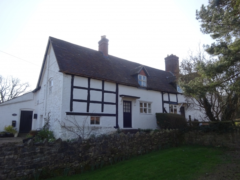
Farmhouse, now divided. Late C17 with late C19 alterations and additions. Timber framed with plastered infill, partly rendered and partly rebuilt in painted brick and stone; banded plain tile roof. L- plan; flush gabled cross wing to right, projecting at rear. Framing: square panels, 3 from sole plate to wall plate. One storey and attic over semi-basement to left. Large brick ridge stack off- centre to right at junction with cross-wing. C19 brick ridge stack off-centre to left, and integral brick lateral stack to right of cross-wing; 2 gabled eaves dormers with 2-light wooden casements. 3-window front; C20 two and 3-light wooden casements; boarded door between first and second windows from right with C20 bracketed porch and half-glazed door to left with c.1900 bracketed porch. C19 gabled brick wing at rear with integral brick end stack. Interior not inspectedbdtlikely to be of interest.
Listing NGR: SO4761698382
External links are from the relevant listing authority and, where applicable, Wikidata. Wikidata IDs may be related buildings as well as this specific building. If you want to add or update a link, you will need to do so by editing the Wikidata entry.


Other nearby listed buildings