Approximate Location Map
Large Map »
Latitude: 52.3703 / 52°22'13"N
Longitude: -1.6676 / 1°40'3"W
OS Eastings: 422728
OS Northings: 274748
OS Grid: SP227747
Mapcode National: GBR 5L1.C6H
Mapcode Global: VHBX2.1PR8
Plus Code: 9C4W98CJ+4X
Entry Name: Woodside
Listing Date: 22 July 1976
Grade: II
Source: Historic England
Source ID: 1367459
English Heritage Legacy ID: 218016
ID on this website: 101367459
Location: Fen End, Solihull, West Midlands, CV8
County: Solihull
Civil Parish: Balsall
Traditional County: Warwickshire
Lieutenancy Area (Ceremonial County): West Midlands
Church of England Parish: Temple Balsall
Church of England Diocese: Birmingham
Tagged with: Building
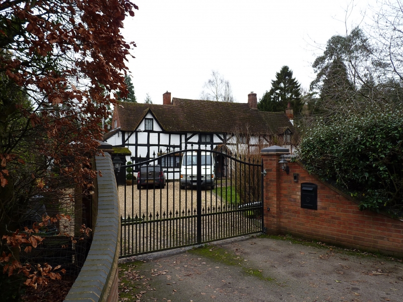
BALSALL FEN END ROAD
1.
5108
(South-West Side)
Woodside
SP 27 SW 13/121
II
2.
C17. Timber frame and whitewashed brick, tiled roof with 4 dormers, storey and
attics, Lattice casement window.
Listing NGR: SP2272874748
External links are from the relevant listing authority and, where applicable, Wikidata. Wikidata IDs may be related buildings as well as this specific building. If you want to add or update a link, you will need to do so by editing the Wikidata entry.


Other nearby listed buildings
