Approximate Location Map
Large Map »
Latitude: 52.4993 / 52°29'57"N
Longitude: -2.5783 / 2°34'41"W
OS Eastings: 360838
OS Northings: 289201
OS Grid: SO608892
Mapcode National: GBR BR.HPXV
Mapcode Global: VH83M.8F9W
Plus Code: 9C4VFCXC+PM
Entry Name: Church Farmhouse
Listing Date: 1 February 1974
Grade: II
Source: Historic England
Source ID: 1367532
English Heritage Legacy ID: 254688
ID on this website: 101367532
Location: Ditton Priors, Shropshire, WV16
County: Shropshire
Civil Parish: Ditton Priors
Built-Up Area: Ditton Priors
Traditional County: Shropshire
Lieutenancy Area (Ceremonial County): Shropshire
Church of England Parish: Ditton Priors
Church of England Diocese: Hereford
Tagged with: Farmhouse
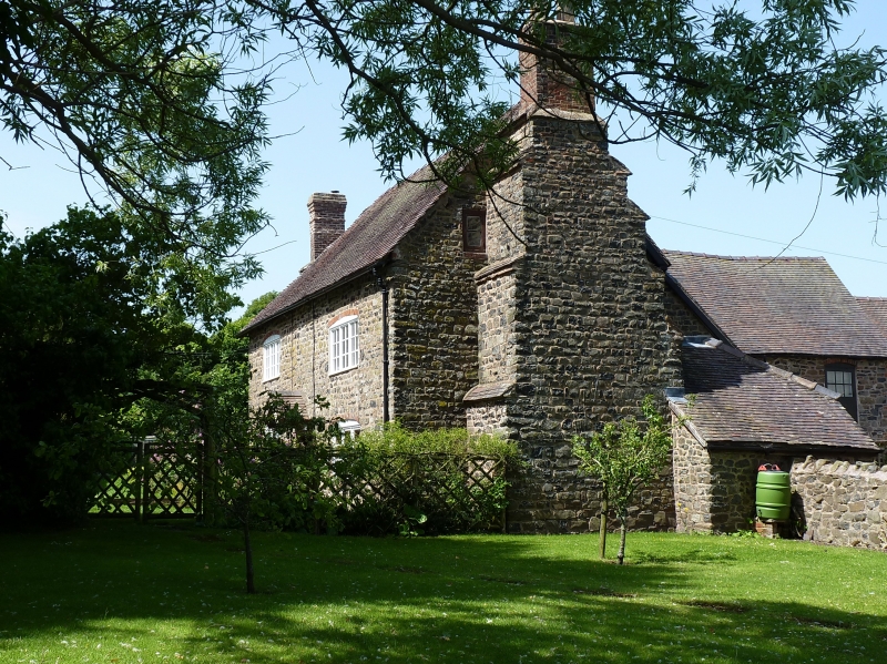
1.
1954 DITTON PRIORS DITTON PRIORS
Church Farm House
SO 68 NW 26/5
II GV
2.
C17 and later. L-shaped on plan. Stone and timber framed with tiled
roof and brick chimneys, two lateral with large stone breasts; 2 storeys;
2 casement windows.
St John's Church, Church Farm House. Howard Arms Hotel and Ditton Farm
House form a group
Listing NGR: SO6083889201
External links are from the relevant listing authority and, where applicable, Wikidata. Wikidata IDs may be related buildings as well as this specific building. If you want to add or update a link, you will need to do so by editing the Wikidata entry.


Other nearby listed buildings
