Latitude: 52.6706 / 52°40'14"N
Longitude: -2.3064 / 2°18'22"W
OS Eastings: 379378
OS Northings: 308141
OS Grid: SJ793081
Mapcode National: GBR 06W.KPS
Mapcode Global: WH9DC.J4YH
Plus Code: 9C4VMMCV+6C
Entry Name: Wall Approximately 10 Metres to North of Byre with Hayloft at Tong Norton Farm
Listing Date: 29 August 1984
Grade: II
Source: Historic England
Source ID: 1367652
English Heritage Legacy ID: 255331
ID on this website: 101367652
Location: Tong Norton, Shropshire, TF11
County: Shropshire
Civil Parish: Tong
Traditional County: Shropshire
Lieutenancy Area (Ceremonial County): Shropshire
Church of England Parish: Tong St Bartholomew
Church of England Diocese: Lichfield
Tagged with: Wall
SJ 70 NE TONG C.P. OFFOXEY ROAD, Tong Norton (South side)
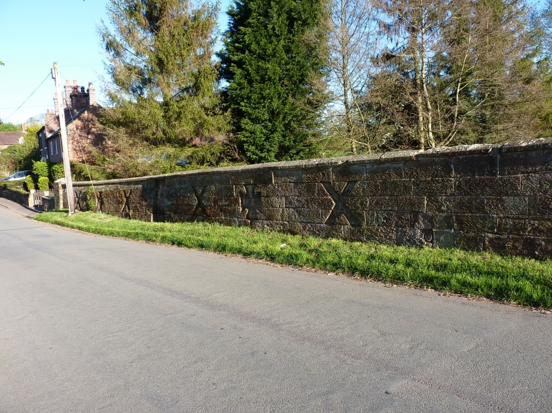
6/15 Wall approximately 10 metres - to North of Byre with Hayloft at Tong Norton Farm.
GV II
Wall. Late C18 or early C19. Squared and coursed sandstone. Approximately 50 metres long and 1.5 metres high, curving round to farm entrance at West. Chamfered coping and square intermediate and end piers with pyramidal coping. 6 bays with second and fifth recessed; first, third, fourth and sixth bays with recessed Latin crosses flanked by recessed Maltese crosses. The wall has many similarities with structures in the area connected with the Durants of Tong Castle (qv. North gates and gate piers, Convent Lodge, Wall with pulpit to East of Convent Lodge). G. Griffith, History of Tong and Boscobel, 1894 pp. 154-61; D. H. Robinson, The Wandering Worfe, Maine Research Publications, 1980. Ch. 3.
Listing NGR: SJ7937808141
External links are from the relevant listing authority and, where applicable, Wikidata. Wikidata IDs may be related buildings as well as this specific building. If you want to add or update a link, you will need to do so by editing the Wikidata entry.


Other nearby listed buildings