Latitude: 51.9595 / 51°57'34"N
Longitude: -1.6393 / 1°38'21"W
OS Eastings: 424880
OS Northings: 229058
OS Grid: SP248290
Mapcode National: GBR 5R4.0CM
Mapcode Global: VHBZ6.J0QQ
Plus Code: 9C3WX956+Q7
Entry Name: Churchyard Cross Remains Approximately 10 Metres South of Chancel of Church of St Mary
Listing Date: 15 May 1989
Grade: II
Source: Historic England
Source ID: 1367762
English Heritage Legacy ID: 253905
ID on this website: 101367762
Location: St Mary's Church, Chastleton, West Oxfordshire, GL56
County: Oxfordshire
District: West Oxfordshire
Civil Parish: Chastleton
Traditional County: Oxfordshire
Lieutenancy Area (Ceremonial County): Oxfordshire
Church of England Parish: Little Compton, Chastleton, Cornwell, Little Rollright and Salford
Church of England Diocese: Oxford
Tagged with: Churchyard cross
CHASTLETON SP2429-2529 11/16 Churchyard cross remains approx. 10m S of chancel of Church of St. Mary
GV II
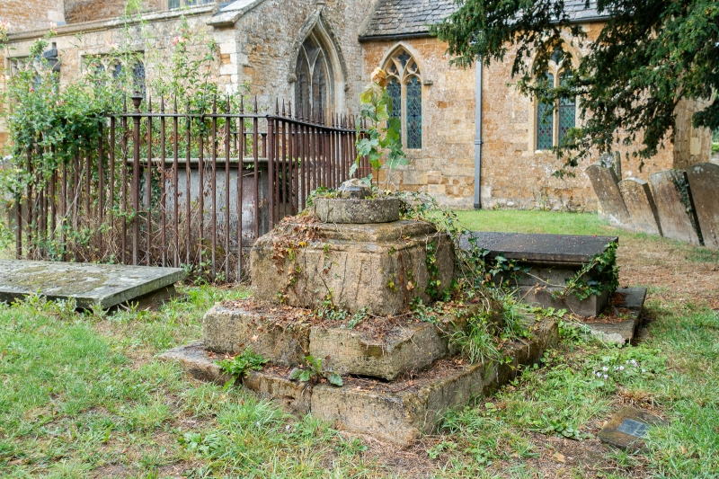
Churchyard cross, remains of. Probably C14 or C15. Limestone. Square stepped moulded plinth on base of 2 square steps. Short section of octagonal shaft with raised quatrefoil decoration (not in situ and probably the upper part of the original shaft) rises from square socket of plinth; C19 Celtic cross-head balanced on top. A Buckler drawing of 1821 shows the Cross to be the same as now without the Celtic cross-head balanced on top. (Bodleian Library: Oxford: MS. Top. gen.a.11 fol.120 no.474; B.J. Marples: The Medieval Crosses of Oxfordshire: Oxeniensia 38 (1973), p305) [2457]
Listing NGR: SP2488029058
External links are from the relevant listing authority and, where applicable, Wikidata. Wikidata IDs may be related buildings as well as this specific building. If you want to add or update a link, you will need to do so by editing the Wikidata entry.


Other nearby listed buildings