Latitude: 51.5877 / 51°35'15"N
Longitude: -1.5289 / 1°31'44"W
OS Eastings: 432731
OS Northings: 187751
OS Grid: SU327877
Mapcode National: GBR 6Y1.J7S
Mapcode Global: VHC10.GC27
Plus Code: 9C3WHFQC+3C
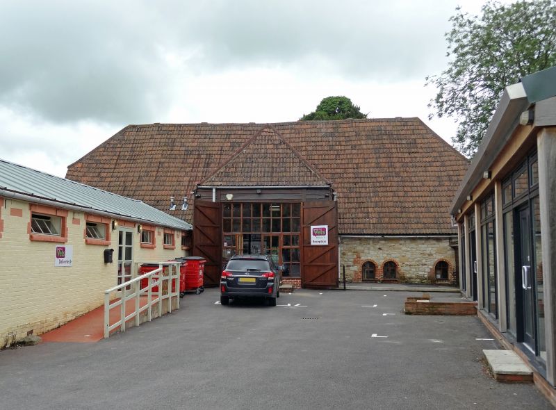
Entry Name: Manor Farm, Barn Approximately 40 Metres East
Listing Date: 11 December 1985
Grade: II
Source: Historic England
Source ID: 1368394
English Heritage Legacy ID: 250734
ID on this website: 101368394
Location: Kingston Lisle, Vale of White Horse, Oxfordshire, OX12
County: Oxfordshire
District: Vale of White Horse
Civil Parish: Kingston Lisle
Built-Up Area: Kingston Lisle
Traditional County: Berkshire
Lieutenancy Area (Ceremonial County): Oxfordshire
Tagged with: Barn
KINGSTON LISLE SU38NW 6/104 Manor Farm, Barn approx 40 metres east
GV II
Barn. C16. Chalk uncoursed rubble to front wall, chalk quoins; rear wall originally timber framed but extra aisle added and chalk rubble walling is C18; weatherboarding to top of gable walls; concrete tiles. 5 bay, with original front aisle, and C18/C19 rear aisle. Central early C19 porch, weatherboarded over brick and sarsen base; half-hipped roof. Interior: Collar truss with arched side struts, butt purlins; windbraced; jowled to post is arch-braced to tie-beam and wall-plate; note use of edge-halved scarfs with short halvings and long bridlings in wall-plate.
Listing NGR: SU3273187751
External links are from the relevant listing authority and, where applicable, Wikidata. Wikidata IDs may be related buildings as well as this specific building. If you want to add or update a link, you will need to do so by editing the Wikidata entry.


Other nearby listed buildings