Latitude: 51.7468 / 51°44'48"N
Longitude: -0.9767 / 0°58'36"W
OS Eastings: 470741
OS Northings: 205834
OS Grid: SP707058
Mapcode National: GBR B0T.KVM
Mapcode Global: VHDVG.1C09
Plus Code: 9C3XP2WF+M8
Entry Name: Island Building to North West End of Street (Readers)
Listing Date: 8 June 1970
Last Amended: 16 June 1988
Grade: II
Source: Historic England
Source ID: 1368780
English Heritage Legacy ID: 248583
ID on this website: 101368780
Location: Thame, South Oxfordshire, OX9
County: Oxfordshire
District: South Oxfordshire
Civil Parish: Thame
Built-Up Area: Thame
Traditional County: Oxfordshire
Lieutenancy Area (Ceremonial County): Oxfordshire
Church of England Parish: Thame St Mary
Church of England Diocese: Oxford
Tagged with: Architectural structure
THAME UPPER HIGH STREET SP7005NE 10/152 Island building to NW end of 08/06/70 street (Readers) (Formerly listed as Island building in centre at west end (occupied by Messrs. Burrows and Bradford))
GV II
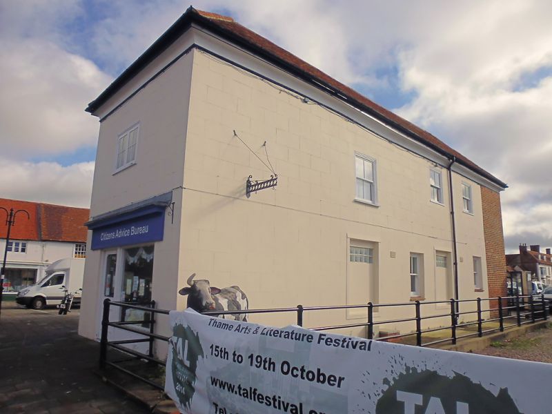
Chapel, now offices. Mid C18 with C19 and C20 alterations. Lined render on brick; old plain-tile hipped roof; brick lateral stacks. 2-storey, 3-bay range with entrance front to north-west end, 2-storey, single-bay. 4-pane door to right. C20 shop window to left. 2-light casement to first floor centre. Coved eaves. Right return: irregular fenestration of 4-pane horned sashes. Interior not inspected.
Listing NGR: SP7074105834
External links are from the relevant listing authority and, where applicable, Wikidata. Wikidata IDs may be related buildings as well as this specific building. If you want to add or update a link, you will need to do so by editing the Wikidata entry.


Other nearby listed buildings