Latitude: 51.7464 / 51°44'47"N
Longitude: -0.9769 / 0°58'36"W
OS Eastings: 470729
OS Northings: 205796
OS Grid: SP707057
Mapcode National: GBR B0T.KTN
Mapcode Global: VHDVG.0CXK
Plus Code: 9C3XP2WF+H6
Entry Name: The Nag's Head Public House
Listing Date: 24 April 1951
Last Amended: 16 June 1988
Grade: II
Source: Historic England
Source ID: 1368803
English Heritage Legacy ID: 248609
ID on this website: 101368803
Location: Thame, South Oxfordshire, OX9
County: Oxfordshire
District: South Oxfordshire
Civil Parish: Thame
Built-Up Area: Thame
Traditional County: Oxfordshire
Lieutenancy Area (Ceremonial County): Oxfordshire
Church of England Parish: Thame St Mary
Church of England Diocese: Oxford
Tagged with: Pub
THAME UPPER HIGH STREET SP7005NE (South-west side) 10/176 No.43 (The Nag's Head Public 24/04/51 House) (Formerly listed as The Nag's Head inn)
GV II
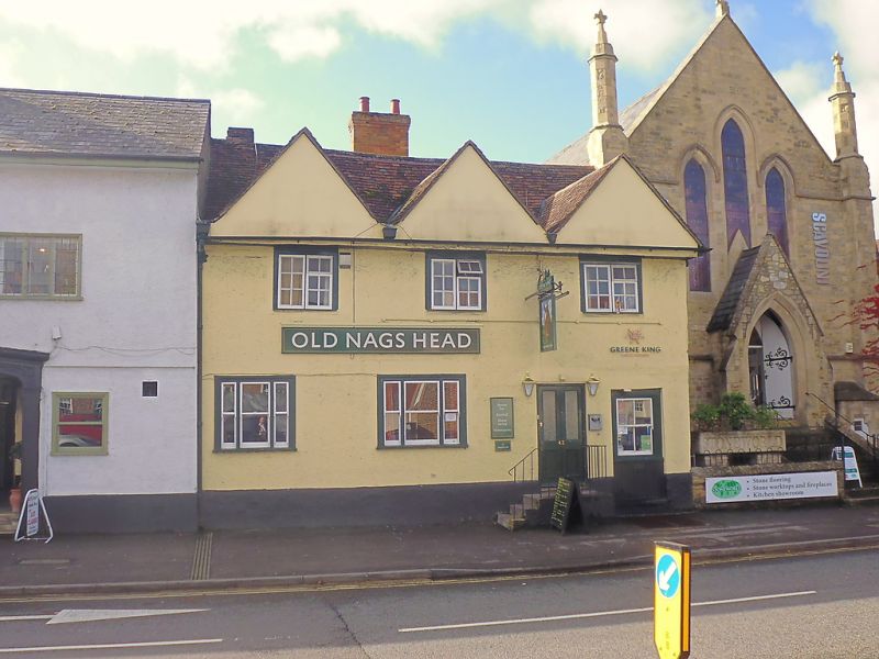
Public house. Probably early C17, with later alterations. Roughcast with rendered quoins, probably on timber fraaing; old plain-tile roof; C20 brick rebuilt stack to rear. 2-storey, 3-window range. C19 four-panel part-glazed door, approached by stone steps, to right of centre. 2 tripartite horned sashes without glazing bars to left and centre. 4-pane horned sash to probable former doorway to right. 2-light wood casements to first floor. 3 jettied cross-gables to roof. Right return: close-studded timber framing with roughcast infill. Interior not inspected.
Listing NGR: SP7072305790
External links are from the relevant listing authority and, where applicable, Wikidata. Wikidata IDs may be related buildings as well as this specific building. If you want to add or update a link, you will need to do so by editing the Wikidata entry.


Other nearby listed buildings