Approximate Location Map
Large Map »
Latitude: 51.6433 / 51°38'35"N
Longitude: -1.1659 / 1°9'57"W
OS Eastings: 457815
OS Northings: 194165
OS Grid: SU578941
Mapcode National: GBR 90F.S3D
Mapcode Global: VHCY8.RY0M
Plus Code: 9C3WJRVM+8M
Entry Name: Garden Wall to Rear of the Pigeons
Listing Date: 14 May 1986
Grade: II
Source: Historic England
Source ID: 1369117
English Heritage Legacy ID: 248104
ID on this website: 101369117
Location: Dorchester, South Oxfordshire, OX10
County: Oxfordshire
District: South Oxfordshire
Civil Parish: Dorchester
Built-Up Area: Dorchester
Traditional County: Oxfordshire
Lieutenancy Area (Ceremonial County): Oxfordshire
Church of England Parish: Dorchester
Church of England Diocese: Oxford
Tagged with: Wall
DORCHESTER HIGH STREET
SU5794 (West side)
5/74 Garden wall to rear of The
Pigeons
GV II
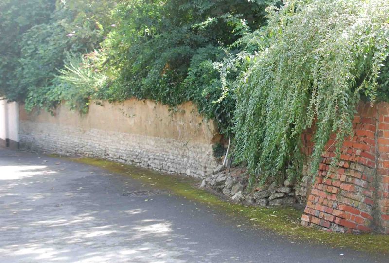
Garden wall. C18/early C19. Cob on clunch rubble base with an old plain-tile
coping. Wall borders north side of garden to rear of The Pigeons for approx.
20m. Included for group value.
Listing NGR: SU5781894165
External links are from the relevant listing authority and, where applicable, Wikidata. Wikidata IDs may be related buildings as well as this specific building. If you want to add or update a link, you will need to do so by editing the Wikidata entry.


Other nearby listed buildings
