Latitude: 51.7517 / 51°45'6"N
Longitude: -1.0897 / 1°5'22"W
OS Eastings: 462935
OS Northings: 206286
OS Grid: SP629062
Mapcode National: GBR B0P.1BL
Mapcode Global: VHCXY.278G
Plus Code: 9C3WQW26+M4
Entry Name: Waterperry House and Attached Wall
Listing Date: 18 July 1963
Last Amended: 5 June 1985
Grade: II*
Source: Historic England
Source ID: 1369255
English Heritage Legacy ID: 246721
ID on this website: 101369255
Location: Waterperry, South Oxfordshire, OX33
County: Oxfordshire
District: South Oxfordshire
Civil Parish: Waterperry with Thomley
Traditional County: Oxfordshire
Lieutenancy Area (Ceremonial County): Oxfordshire
Church of England Parish: Waterperry
Church of England Diocese: Oxford
Tagged with: Architectural structure
WATERPERRY SP60NW 6/201 Waterperry House and attached 18/07/63 wall (Formerly listed as Waterperry Horticultural School)
GV II*
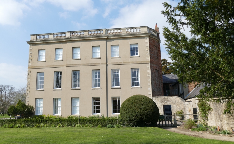
Mansion, now college. c.1713 for Sir John Curson, incorporating late C17 wing: altered c.1820 for Henley family. Stucco with limestone ashlar dressings; brick; squared coursed limestone rubble; Welsh-slate and old plain-tile roofs. Double-depth plan with U-plan rear wing. 3 storeys with 2-storey rear wing. Main block, with heavy cornice, balustraded parapet and projecting quoins, has 7-window front, the central bay breaking forward slightly, with a large Ionic-mullioned Venetian window at first floor above an Ionic tetrastyle balustraded portico beneath which is a double-leaf 6-panel door flanked by narrow lights set in chamfered rustication. 6-window return walls have central 2 bays breaking forward, more prominently to left. Rear wall includes a 3-storey bowed section in English-bond brickwork. Tiled hipped roof. Service range to rear incorporates the earlier rubble house, facing to right, which has a central 6-panel door and short projecting wings at each end of the range, that to left further extended and incorporating a stone arched doorway of 2 chamfered orders which may be C14. At first floor in the front and wings are leaded wood-framed cross windows, and the rear has rows of similar windows on both floors. Left wing has stucco oval set between 4 fleurs-de-lys which contains the date 1705. Hipped roof (which is slated at the front and tiled elsewhere, has a ridge stack to right of centre and a stack on the flush rear gable of the left wing which originally extended to the rear). Rear hopper head is dated 1799. Interior: Main block has columned hall leading to stair hall containing late C18/early C19 open-well stair with ramped and wreathed handrail; arched window contains mostly-continental C16 and C17 painted glass. Back stair has late C17 twisted balusters and ramped handrail, probably a C18 re-arrangement. Early c18 panelled room has blocked arched doorway flanked by fluted pilasters supporting an entablature incorporating the dentil cornice. C17 wing has large internal stack and butt-purlin roof. Brick and rubble wall runs from rear wing to Church of St. Mary (q.v.). (V.C.H.: Oxfordshire, Vol.V, p.296; Buildings of England: Oxfordshire. p,828),
Listing NGR: SP6293706283
External links are from the relevant listing authority and, where applicable, Wikidata. Wikidata IDs may be related buildings as well as this specific building. If you want to add or update a link, you will need to do so by editing the Wikidata entry.


Other nearby listed buildings