Latitude: 51.7614 / 51°45'40"N
Longitude: -1.2607 / 1°15'38"W
OS Eastings: 451120
OS Northings: 207224
OS Grid: SP511072
Mapcode National: GBR 8YY.D42
Mapcode Global: VHCXN.3ZCM
Plus Code: 9C3WQP6Q+HP
Entry Name: 27, Banbury Road
Listing Date: 28 June 1972
Grade: II
Source: Historic England
Source ID: 1369321
English Heritage Legacy ID: 245296
ID on this website: 101369321
Location: Norham Manor, Oxford, Oxfordshire, OX2
County: Oxfordshire
District: Oxford
Electoral Ward/Division: North
Parish: Non Civil Parish
Built-Up Area: Oxford
Traditional County: Oxfordshire
Lieutenancy Area (Ceremonial County): Oxfordshire
Church of England Parish: Oxford St Giles
Church of England Diocese: Oxford
Tagged with: Building
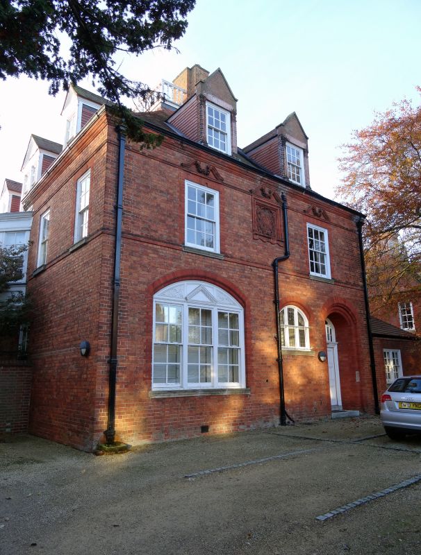
BANBURY ROAD 1. 1485 (West Side) No 27 SP 5107 SW 3/105A II 2. 1881. By J J Stevenson. Brick in the Queen Anne style of the period. Hipped tiled roof. Dormers with pediments. 2 storeys. Sash windows with wooden architraves. Moulded brick eaves cornice. The hipped roof is surmounted by a flat roof with wooden balustrade. Outstanding example in local context.
Listing NGR: SP5112007224
External links are from the relevant listing authority and, where applicable, Wikidata. Wikidata IDs may be related buildings as well as this specific building. If you want to add or update a link, you will need to do so by editing the Wikidata entry.


Other nearby listed buildings