Approximate Location Map
Large Map »
Latitude: 51.7493 / 51°44'57"N
Longitude: -1.2579 / 1°15'28"W
OS Eastings: 451328
OS Northings: 205883
OS Grid: SP513058
Mapcode National: GBR 8Z4.6SM
Mapcode Global: VHCXV.49VB
Plus Code: 9C3WPPXR+PR
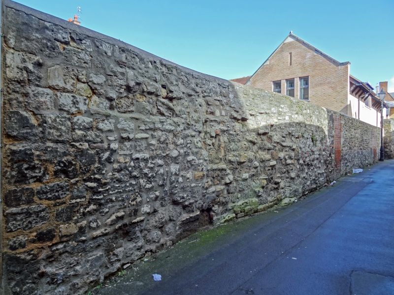
Entry Name: Boundary Wall of Number 3 Fronting Rose Place
Listing Date: 28 June 1972
Grade: II
Source: Historic England
Source ID: 1369351
English Heritage Legacy ID: 245343
ID on this website: 101369351
Location: Oxford, Oxfordshire, OX1
County: Oxfordshire
District: Oxford
Electoral Ward/Division: Carfax
Parish: Non Civil Parish
Built-Up Area: Oxford
Traditional County: Oxfordshire
Lieutenancy Area (Ceremonial County): Oxfordshire
Church of England Parish: Oxford St Aldate
Church of England Diocese: Oxford
Tagged with: Wall
BREWER STREET
1.
1485
(South Side)
Boundary wall of No 3
fronting Rose Place
SP 51C5 NW 12/689A
II
2.
Medieval rubble wall, much patched and with bricked up openings.
Listing NGR: SP5132805882
External links are from the relevant listing authority and, where applicable, Wikidata. Wikidata IDs may be related buildings as well as this specific building. If you want to add or update a link, you will need to do so by editing the Wikidata entry.


Other nearby listed buildings
