Latitude: 51.7522 / 51°45'7"N
Longitude: -1.2631 / 1°15'47"W
OS Eastings: 450967
OS Northings: 206199
OS Grid: SP509061
Mapcode National: GBR 7XS.5GV
Mapcode Global: VHCXV.2733
Plus Code: 9C3WQP2P+VQ
Entry Name: Well House Oxford Castle
Listing Date: 12 January 1954
Last Amended: 18 February 1993
Grade: I
Source: Historic England
Source ID: 1369493
English Heritage Legacy ID: 246003
Also known as: Well House, Oxford Castle
ID on this website: 101369493
Location: Oxford, Oxfordshire, OX1
County: Oxfordshire
District: Oxford
Electoral Ward/Division: Carfax
Parish: Non Civil Parish
Built-Up Area: Oxford
Traditional County: Oxfordshire
Lieutenancy Area (Ceremonial County): Oxfordshire
Church of England Parish: Oxford St Barnabas with St Thomas the Martyr
Church of England Diocese: Oxford
Tagged with: Well house
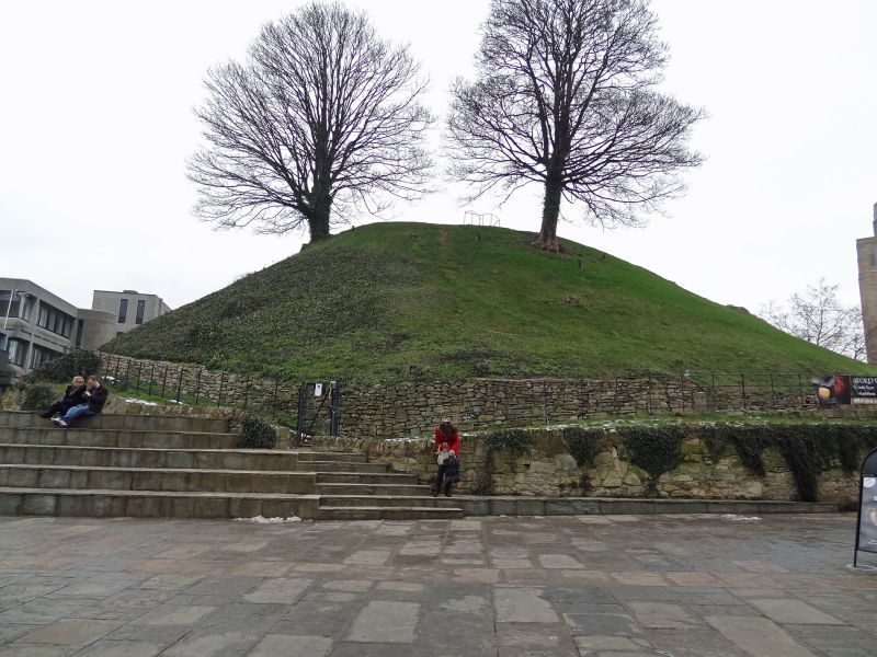
HM PRISON OXFORD NEW ROAD SF 5006 SE 7/10014 Well House Oxford Castle GV I Motte to former castle with Well Chamber. Mound, c1071 as the motte of Oxford Castle built for Robert d'Oilly to provide a means for the Normans to control the town and the Upper Thames Valley. Earth. Circular plan. Approximately 80 feet high, base diameter about 250 feet, top diameter about 60 feet. Originally there would have been a wooden keep. Constructed by forced Saxon labour. The Well Chamber. Early C13. Rubble stone. Entrance with 3 stones bearing shield-of- arms thought to be of Fox, Bishop of Winchester, the see of Durham and Newcastle, Bishop of Exeter. A flight of steps leads down about 20 feet into a hexagonal plan chamber with stone vaulted roof supported on chamfered ribs. Oxford Castle was slighted in 1652. In 1776 New Road was built across the northern part of the Bailey and in 1785 the County Justices acquired the site to build a new Oxford Prison which incorporated the only other surviving elements of the castle viz. St. George's Tower (qv), St. George's Chapel Crypt (qv) and the batter from the Round Tower (qv). The castle saw little action apart from during the Anarchy in 1142 when King Stephen besieged the Empress Matilda and it was attacked in the Baron's War of 1215. There had been prison buildings within the bailey since the C12.
Listing NGR: SP5152606221
External links are from the relevant listing authority and, where applicable, Wikidata. Wikidata IDs may be related buildings as well as this specific building. If you want to add or update a link, you will need to do so by editing the Wikidata entry.


Other nearby listed buildings