Latitude: 51.5368 / 51°32'12"N
Longitude: -0.904 / 0°54'14"W
OS Eastings: 476110
OS Northings: 182559
OS Grid: SU761825
Mapcode National: GBR C4S.L7R
Mapcode Global: VHDWG.8MYR
Plus Code: 9C3XG3PW+P9
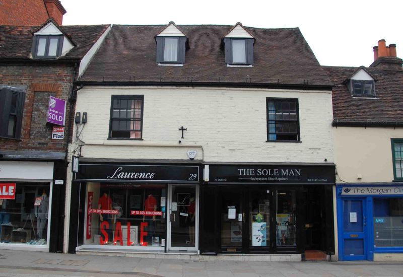
Entry Name: 29 and 31, Duke Street
Listing Date: 28 October 1974
Grade: II
Source: Historic England
Source ID: 1369508
English Heritage Legacy ID: 246086
ID on this website: 101369508
Location: Henley-on-Thames, South Oxfordshire, RG9
County: Oxfordshire
District: South Oxfordshire
Civil Parish: Henley-on-Thames
Built-Up Area: Henley-on-Thames
Traditional County: Oxfordshire
Lieutenancy Area (Ceremonial County): Oxfordshire
Church of England Parish: Henley-on-Thames
Church of England Diocese: Oxford
Tagged with: Building
This list entry was subject to a Minor Amendment on 28 October 2024 to amend name and address and to reformat the text to current standards.
SU 7582
1/233
DUKE STREET (east side)
Nos 29 and 31
(Formerly listed as No 31)
GV
II
C18 facade to probably earlier house. Painted brick with large, steeply pitched, old tiled roof. Two storeys and dormers, one window each and gabled dormers. First floor, flush frame sashes with glazing bars. Ground floor has modern shop fronts.
Nos 29 to 35 (odd) form a group.
Listing NGR: SU7611082573
External links are from the relevant listing authority and, where applicable, Wikidata. Wikidata IDs may be related buildings as well as this specific building. If you want to add or update a link, you will need to do so by editing the Wikidata entry.


Other nearby listed buildings