Latitude: 54.9487 / 54°56'55"N
Longitude: -1.9715 / 1°58'17"W
OS Eastings: 401922
OS Northings: 561564
OS Grid: NZ019615
Mapcode National: GBR GCN6.ZT
Mapcode Global: WHB2F.PWD3
Plus Code: 9C6WW2XH+F9
Entry Name: Station Footbridge at Riding Mill Station
Listing Date: 17 February 1982
Grade: II
Source: Historic England
Source ID: 1370263
English Heritage Legacy ID: 240441
Also known as: Riding Mill station footbridge
ID on this website: 101370263
Location: Riding Mill, Northumberland, NE44
County: Northumberland
Civil Parish: Broomhaugh and Riding
Built-Up Area: Riding Mill
Traditional County: Northumberland
Lieutenancy Area (Ceremonial County): Northumberland
Church of England Parish: St James, Riding Mill
Church of England Diocese: Newcastle
Tagged with: Railway footbridge
BROOMHAUGH AND RIDING RIDING MILL NZ 22/74 Station Footbridge at Riding Mill Station I7.2.82
GV II
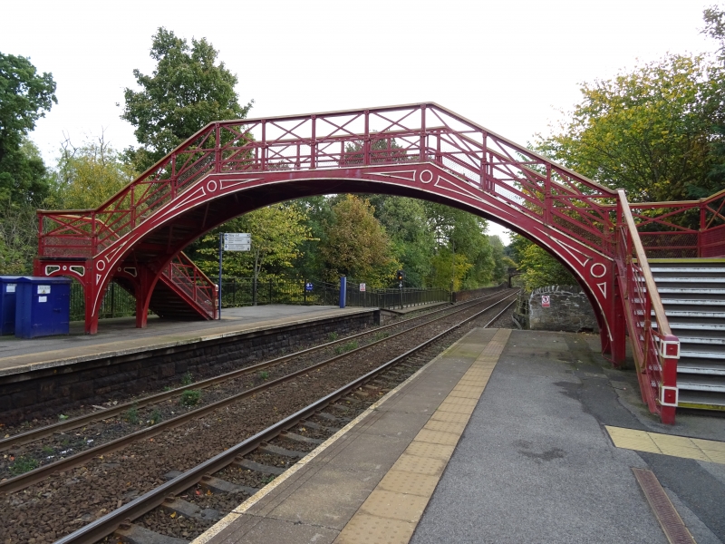
Passenger footbridge, late C19. For North-Eastern Railway. Cast iron. Wide elliptical arch with angled flights of steps to either side, to square landings on open arches. Riveted corner piers, raised pattern in bridge spandrels, open spandrels to landings. Parapet with riveted posts, rails and diagonal struts.
Listing NGR: NZ0192261564
External links are from the relevant listing authority and, where applicable, Wikidata. Wikidata IDs may be related buildings as well as this specific building. If you want to add or update a link, you will need to do so by editing the Wikidata entry.


Other nearby listed buildings