Latitude: 54.968 / 54°58'4"N
Longitude: -2.4625 / 2°27'45"W
OS Eastings: 370487
OS Northings: 563805
OS Grid: NY704638
Mapcode National: GBR CB7Z.NX
Mapcode Global: WH912.4DN9
Plus Code: 9C6VXG9P+5X
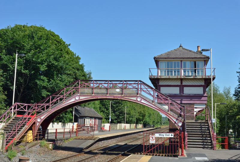
Entry Name: Footbridge Connecting Platforms at Haltwhistle Railway
Listing Date: 27 July 1987
Grade: II
Source: Historic England
Source ID: 1370340
English Heritage Legacy ID: 240762
ID on this website: 101370340
Location: Haltwhistle, Northumberland, NE49
County: Northumberland
Civil Parish: Haltwhistle
Built-Up Area: Haltwhistle
Traditional County: Northumberland
Lieutenancy Area (Ceremonial County): Northumberland
Church of England Parish: Haltwhistle Holy Cross
Church of England Diocese: Newcastle
Tagged with: Railway footbridge
HALTWHISTLE STATION ROAD NY 76 SW (East side, off) 16/28 Footbridge connecting platforms at Haltwhistle Railway Station GV II
Footbridge connecting north and south platforms. Late C19 for the North Eastern Railway Company. Cast iron. U-plan. Wide elliptical arch across tracks carries horizontal walkway. L-plan stair sections flanking arch are supported by transverse round arches on squat corner posts. Railings: standards with moulded square knops; cross-bracing between middle and top rails.
Listing NGR: NY7048763805
External links are from the relevant listing authority and, where applicable, Wikidata. Wikidata IDs may be related buildings as well as this specific building. If you want to add or update a link, you will need to do so by editing the Wikidata entry.


Other nearby listed buildings