Latitude: 53.4404 / 53°26'25"N
Longitude: -0.833 / 0°49'58"W
OS Eastings: 477618
OS Northings: 394365
OS Grid: SK776943
Mapcode National: GBR QXMN.GG
Mapcode Global: WHFFR.5SMF
Plus Code: 9C5XC5R8+4R
Entry Name: Gate piers and gate at Misterton Station House
Listing Date: 23 November 1984
Grade: II
Source: Historic England
Source ID: 1370420
English Heritage Legacy ID: 241163
ID on this website: 101370420
Location: Misterton, Bassetlaw, Nottinghamshire, DN10
County: Nottinghamshire
District: Bassetlaw
Civil Parish: Misterton
Traditional County: Nottinghamshire
Lieutenancy Area (Ceremonial County): Nottinghamshire
Church of England Parish: Misterton
Church of England Diocese: Southwell and Nottingham
This list entry was subject to a Minor Amendment on 21 January 2025 to correct a typo in the Name and Address and to reformat the text to current standards
SK 79 SE
6/78A
MISTERTON
GAINSBOROUGH ROAD (west side)
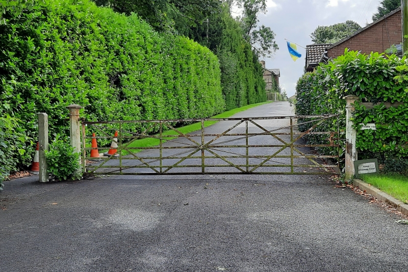
Gate piers and gate at Misterton Station House
G.V.
II
A pair of gatepiers and gate, c.1875; cast and wrought iron. Octagonal gatepiers with pointed octagonal caps, carrying five barred angle iron gate with diagonal bracing and tie rods.
Included for group value only.
Listing NGR: SK7761894365
External links are from the relevant listing authority and, where applicable, Wikidata. Wikidata IDs may be related buildings as well as this specific building. If you want to add or update a link, you will need to do so by editing the Wikidata entry.


Other nearby listed buildings