Approximate Location Map
Large Map »
Latitude: 54.9714 / 54°58'17"N
Longitude: -2.1013 / 2°6'4"W
OS Eastings: 393613
OS Northings: 564094
OS Grid: NY936640
Mapcode National: GBR FBRY.WP
Mapcode Global: WHB2C.P9LP
Plus Code: 9C6VXVCX+HF
Entry Name: Shambles
Listing Date: 2 October 1951
Grade: II*
Source: Historic England
Source ID: 1370800
English Heritage Legacy ID: 239165
ID on this website: 101370800
Location: Hexham, Northumberland, NE46
County: Northumberland
Civil Parish: Hexham
Built-Up Area: Hexham
Traditional County: Northumberland
Lieutenancy Area (Ceremonial County): Northumberland
Church of England Parish: Hexham
Church of England Diocese: Newcastle
Tagged with: Market hall
NY 9364 1/5
5334
MARKET PLACE
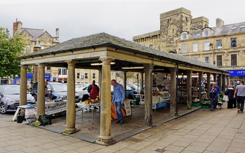
Shambles
2.10.51.
II* GV
Covered market erected by Sir Walter Blackett in 1766 with stone columns. 9 x 3 bays. Stone columns to front, back columns of wood. Moulded cast iron gutter. Shallow double pitched slate roof.
St Andrew's Church together with the listed buildings in the Market Place form a group, of which Nos 8, 10 and 16 are of local interest.
Listing NGR: NY9361364095
External links are from the relevant listing authority and, where applicable, Wikidata. Wikidata IDs may be related buildings as well as this specific building. If you want to add or update a link, you will need to do so by editing the Wikidata entry.


Other nearby listed buildings
