Latitude: 55.771 / 55°46'15"N
Longitude: -2.0064 / 2°0'23"W
OS Eastings: 399694
OS Northings: 653078
OS Grid: NT996530
Mapcode National: GBR G1FQ.D2
Mapcode Global: WH9YK.46TP
Plus Code: 9C7VQXCV+CC
Entry Name: Scotsgate
Listing Date: 26 May 1971
Grade: I
Source: Historic England
Source ID: 1370836
English Heritage Legacy ID: 237349
ID on this website: 101370836
Location: Berwick-upon-Tweed, Northumberland, TD15
County: Northumberland
Civil Parish: Berwick-upon-Tweed
Built-Up Area: Berwick-upon-Tweed
Traditional County: Northumberland
Lieutenancy Area (Ceremonial County): Northumberland
Church of England Parish: Berwick Holy Trinity and St Mary
Church of England Diocese: Newcastle
Tagged with: Building
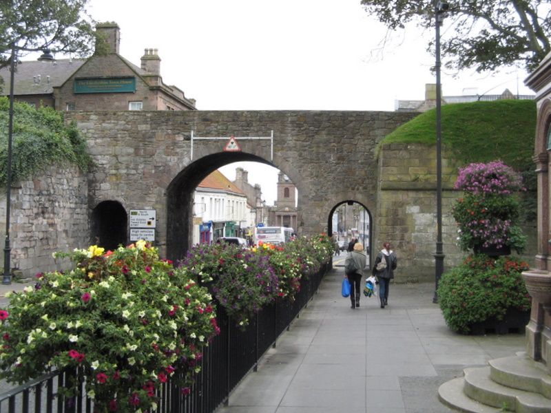
1. 840 MARYGATE (South Side) Scotsgate NT 9953 11/124 I 2. Part of Town Fortifications. Originally Elizabethan, altered 1815 and again in 1858. High plain stone walls punctured by 3 arches - a large segmental arched entrance over the Great North Road, flanking round arched entrances over footpaths, all with plain voussoirs. Hinges remain for former gate. Round arch at right angles on North side, with flight of steps leading up to Greenside Avenue, and Town Walls. Scheduled AM.
Listing NGR: NT9964553145
External links are from the relevant listing authority and, where applicable, Wikidata. Wikidata IDs may be related buildings as well as this specific building. If you want to add or update a link, you will need to do so by editing the Wikidata entry.


Other nearby listed buildings