Latitude: 52.1196 / 52°7'10"N
Longitude: -1.2108 / 1°12'38"W
OS Eastings: 454133
OS Northings: 247102
OS Grid: SP541471
Mapcode National: GBR 8TR.0QD
Mapcode Global: VHCVX.YZSH
Plus Code: 9C4W4Q9Q+RM
Entry Name: Dial House and Fairway Cottage
Listing Date: 4 July 1985
Grade: II
Source: Historic England
Source ID: 1371813
English Heritage Legacy ID: 234043
ID on this website: 101371813
Location: Culworth, West Northamptonshire, OX17
County: West Northamptonshire
Civil Parish: Culworth
Built-Up Area: Culworth
Traditional County: Northamptonshire
Lieutenancy Area (Ceremonial County): Northamptonshire
Church of England Parish: Culworth St Mary the Virgin
Church of England Diocese: Peterborough
Tagged with: Cottage
SP5447 CULWORTH HIGH STREET (North side) 10/14 Dial House and Fairway Cottage II
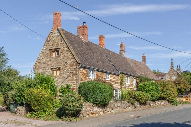
Pair of Cottages. C17. Coursed limestone rubble banded with ironstone; artificial stone slate roof, brick stacks. 2 storeys and attic. Cottage to right (Fairway), 2 bays, has central doorway with wood lintel, 4-panel part-glazed door and timber lattice-work porch. 3-light casement window with wood lintel on either side. Similar windows on first floor. Dial House (to left) 4 bays, has doorway in right bay with plank door, side-lights and wood lintel. 3-light casement window with wood lintel to left. C20 bay window in second bay-from left and 3-light casement window with wood lintel in left bay. 3-light casement window with wood lintel in right bay and second bay from right on first floor. Similar 2-light windows in left bay and second bay from right. Coped left gable with kneelers. Blocked 2-light stone mullioned window to first floor and attic on left side. Interior not inspected.
Listing NGR: SP5413347102
External links are from the relevant listing authority and, where applicable, Wikidata. Wikidata IDs may be related buildings as well as this specific building. If you want to add or update a link, you will need to do so by editing the Wikidata entry.


Other nearby listed buildings