Latitude: 52.6279 / 52°37'40"N
Longitude: 1.2937 / 1°17'37"E
OS Eastings: 623008
OS Northings: 308442
OS Grid: TG230084
Mapcode National: GBR W90.SK
Mapcode Global: WHMTM.V67Q
Plus Code: 9F43J7HV+5F
Entry Name: The Fruiterer's Arms
Listing Date: 5 June 1972
Grade: II
Source: Historic England
Source ID: 1372522
English Heritage Legacy ID: 229747
Also known as: Fruiterers Arms, Norwich
Fruiterers Arms
ID on this website: 101372522
Location: Norwich, Norfolk, NR2
County: Norfolk
District: Norwich
Electoral Ward/Division: Mancroft
Parish: Non Civil Parish
Built-Up Area: Norwich
Traditional County: Norfolk
Lieutenancy Area (Ceremonial County): Norfolk
Church of England Parish: Norwich St Peter, Mancroft with St John Maddermarket
Church of England Diocese: Norwich
Tagged with: Pub
This list entry was subject to a Minor Amendment on 27 February 2026 to amend the name and description due to a change in building use and reformat the text to current standards
TG 2308 SW
23/951
WHITE LION STREET (north side)
Nos. 2 and 4 (Former Fruiterer's Arms)
(formerly listed as Nos. 2 and 4 (The Fruiterer's Arms))
5.6.72.
II
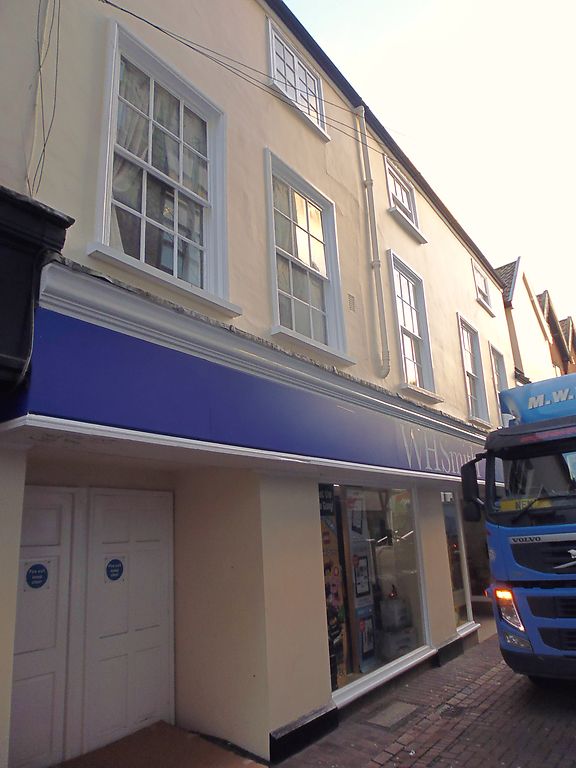
Former use unknown now public house. C17 heightened in the C18 with C20 alterations. Rendered. Pantile roof. Three storeys, two storeys plus attic to right-side. Jettied at first floor. 6 first floor windows. C20 pub front with off-centre door, casement windows and long fascia. Sash windows with glazing bars and simply moulded surrounds and one casement window on upper floors. Fascia cornice. Blind dormer gable to right-side.
Listing NGR: TG2300808442
External links are from the relevant listing authority and, where applicable, Wikidata. Wikidata IDs may be related buildings as well as this specific building. If you want to add or update a link, you will need to do so by editing the Wikidata entry.


Other nearby listed buildings