Latitude: 51.6379 / 51°38'16"N
Longitude: -2.3499 / 2°20'59"W
OS Eastings: 375884
OS Northings: 193294
OS Grid: ST758932
Mapcode National: GBR 0MF.6Q9
Mapcode Global: VH95G.7326
Plus Code: 9C3VJMQ2+53
Entry Name: Chapel at Hugh Perry Almshouses
Listing Date: 23 June 1952
Last Amended: 16 August 1984
Grade: II
Source: Historic England
Source ID: 1373863
English Heritage Legacy ID: 128077
ID on this website: 101373863
Location: Wotton-under-Edge, Stroud, Gloucestershire, GL12
County: Gloucestershire
District: Stroud
Civil Parish: Wotton-under-Edge
Built-Up Area: Wotton-under-Edge
Traditional County: Gloucestershire
Lieutenancy Area (Ceremonial County): Gloucestershire
Church of England Parish: Wotton-under-Edge with Ozleworth
Church of England Diocese: Gloucester
Tagged with: Chapel
ST 7693 4/33 WOTTON-UNDER-EDGE CHURCH STREET 23.6.52 (east)
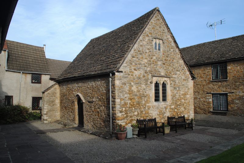
Chapel at Hugh Perry Almshouses (formerly listed as Chapel in Almshouses Courtyard)
II
Chapel. C17. Rubble, stone slate roof. Free-standing two-bay single space building in courtyard of Almshouses. Entrance on long west side. Two light cusped stone windows with semi-circular hearts, and two smaller similar in upper levels of gables, all with drips and labels.
Listing NGR: ST7588493294
External links are from the relevant listing authority and, where applicable, Wikidata. Wikidata IDs may be related buildings as well as this specific building. If you want to add or update a link, you will need to do so by editing the Wikidata entry.


Other nearby listed buildings