Approximate Location Map
Large Map »
Latitude: 52.5287 / 52°31'43"N
Longitude: -2.3234 / 2°19'24"W
OS Eastings: 378154
OS Northings: 292363
OS Grid: SO781923
Mapcode National: GBR 08M.FDD
Mapcode Global: VH910.PP1V
Plus Code: 9C4VGMHG+FJ
Entry Name: Farmcote House
Listing Date: 9 March 1970
Grade: II
Source: Historic England
Source ID: 1374835
English Heritage Legacy ID: 254623
ID on this website: 101374835
Location: Farmcote, Shropshire, WV5
County: Shropshire
Civil Parish: Claverley
Traditional County: Shropshire
Lieutenancy Area (Ceremonial County): Shropshire
Church of England Parish: Claverley
Church of England Diocese: Hereford
Tagged with: House
1.
1954 CLAVERLEY
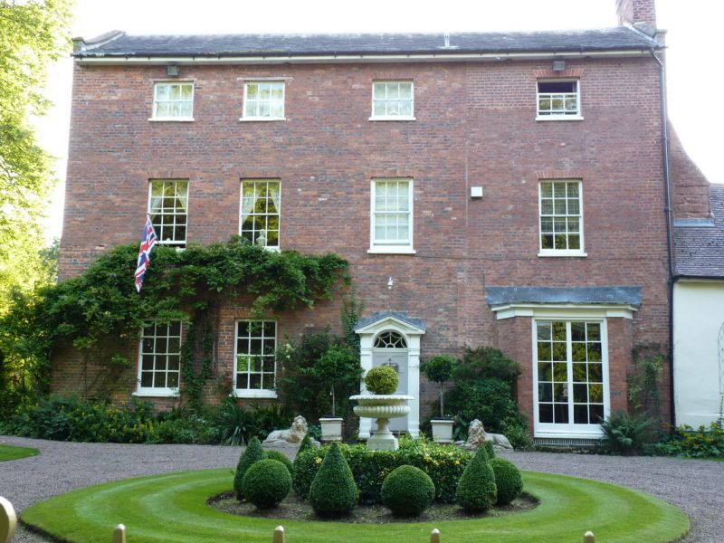
Farmcote Hall
SO 79 SE 23/32 9.3.70.
II
2.
C18. Red brick; 3 storeys; 4 sash windows with painted reveals; open
pedimented doorway with flat fluted pilasters and fanlight; old ridge
tiled roof. Brick gable end at side has Regency splayed bay of 2 storeys
surmounted by railed verandah; attic triple window with shell ornament
above.
Listing NGR: SO7815492363
External links are from the relevant listing authority and, where applicable, Wikidata. Wikidata IDs may be related buildings as well as this specific building. If you want to add or update a link, you will need to do so by editing the Wikidata entry.


Other nearby listed buildings
