Latitude: 53.8088 / 53°48'31"N
Longitude: -1.5906 / 1°35'26"W
OS Eastings: 427054
OS Northings: 434802
OS Grid: SE270348
Mapcode National: GBR B6G.YF
Mapcode Global: WHC9C.JJSG
Plus Code: 9C5WRC55+GP
Entry Name: Spinning or Weaving Range at Burley Mills
Listing Date: 1 November 1991
Grade: II
Source: Historic England
Source ID: 1375054
English Heritage Legacy ID: 465934
ID on this website: 101375054
Location: Burley, Leeds, West Yorkshire, LS4
County: Leeds
Electoral Ward/Division: Kirkstall
Parish: Non Civil Parish
Built-Up Area: Leeds
Traditional County: Yorkshire
Lieutenancy Area (Ceremonial County): West Yorkshire
Church of England Parish: Burley St Matthias
Church of England Diocese: Leeds
Tagged with: Building
LEEDS
SE2734 KIRKSTALL ROAD 714-1/28/929 (South side) 01/11/91 Spinning or weaving range at Burley Mills
GV II
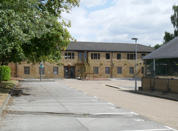
Spinning or weaving range, now offices. Early C19. For the firm of Wormald, Gott and Wormald, later alterations. Coursed sandy gritstone, part rendered, felted hipped roof. 2 storeys, 11 windows on east side, at right angle to road, the 3-window north end originally extended along road way to west, across frontage of mill yard and linked to arched entrance (demolished). Ground-floor openings altered, first-floor east and west sides have original 3-light mullion windows, some altered to 2 lights. INTERIOR: not inspected. Part of the important Burley Mills group, see main range (qv) for historical information. The early window form is similar to that of the demolished cottages and the building is a rare survival of the early stages of factory design when forms were based on that of domestic buildings.
Listing NGR: SE2705434802
External links are from the relevant listing authority and, where applicable, Wikidata. Wikidata IDs may be related buildings as well as this specific building. If you want to add or update a link, you will need to do so by editing the Wikidata entry.


Other nearby listed buildings