Latitude: 53.8207 / 53°49'14"N
Longitude: -1.5801 / 1°34'48"W
OS Eastings: 427742
OS Northings: 436123
OS Grid: SE277361
Mapcode National: GBR B9B.65
Mapcode Global: WHC9C.P7SC
Plus Code: 9C5WRCC9+7X
Entry Name: Lodge, Gate Piers and Boundary Wall to Former North Lane Pumping Station
Listing Date: 11 September 1996
Grade: II
Source: Historic England
Source ID: 1375263
English Heritage Legacy ID: 466145
ID on this website: 101375263
Location: Headingley, Leeds, West Yorkshire, LS6
County: Leeds
Electoral Ward/Division: Headingley
Parish: Non Civil Parish
Built-Up Area: Leeds
Traditional County: Yorkshire
Lieutenancy Area (Ceremonial County): West Yorkshire
Church of England Parish: Headingley St Michael
Church of England Diocese: Leeds
Tagged with: Building
LEEDS
SE2736SE NORTH LANE, Headingley 714-1/61/806 (South East side) Lodge, gate piers and boundary wall to former North Lane Pumping Station
GV II
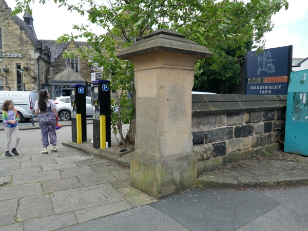
Lodge, gate piers and boundary wall to pumping station. 1879-80, altered 1993-4. For the former Leeds Corporation Waterworks. Rock-faced ashlar, plain stone dressings and slate roof to lodge, ashlar gate piers, coursed squared gritstone walls. INTERIOR: not inspected. The walling extended from the corner of the former public library (not included) SW of the lodge along the North Lane boundary for a distance of approx 80m, now with wide central entrance (instead of former entrance). Lodge: quoins, plinth; a small square single-storey building with steeply-pitched roof and stepped gable copings; entrance on SE side and large rectangular window on NE, both blocked. Boundary wall, stepped up and with stepped gabled copings. Gate piers square, chamfered, with wide pyramidal capstones. Formerly 1 pedestrian gate and a pair of gates in same style: bars and dog bars with scroll finials, scrolled top rail.
Listing NGR: SE2774236123
External links are from the relevant listing authority and, where applicable, Wikidata. Wikidata IDs may be related buildings as well as this specific building. If you want to add or update a link, you will need to do so by editing the Wikidata entry.


Other nearby listed buildings