Latitude: 53.1931 / 53°11'35"N
Longitude: -2.8866 / 2°53'11"W
OS Eastings: 340858
OS Northings: 366593
OS Grid: SJ408665
Mapcode National: GBR 7B.2THV
Mapcode Global: WH887.MZMZ
Plus Code: 9C5V54V7+68
Entry Name: 7, Queens Place
Listing Date: 10 January 1972
Last Amended: 23 July 1998
Grade: II
Source: Historic England
Source ID: 1375916
English Heritage Legacy ID: 469895
ID on this website: 101375916
Location: Newtown, Cheshire West and Chester, Cheshire, CH1
County: Cheshire West and Chester
Electoral Ward/Division: Chester City
Parish: Non Civil Parish
Built-Up Area: Chester
Traditional County: Cheshire
Lieutenancy Area (Ceremonial County): Cheshire
Church of England Parish: Chester St John the Baptist
Church of England Diocese: Chester
Tagged with: Building
CHESTER CITY (EM)
SJ4066 QUEEN'S PLACE 1932-1/6/236 (East side) 10/01/72 No.7 (Formerly Listed as: QUEEN STREET No.40)
GV II
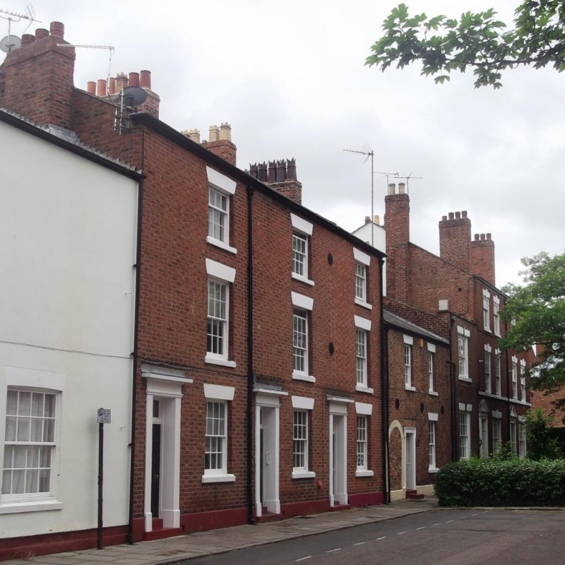
Town house, probably formerly with workshop. Late C18, with C19 alteration. Flemish bond brown brick with some pale headers; grey slate roof. 2 storeys, 2 bays. Painted stone plinth; 6-panel door in eared architrave with panelled jambs and soffit; a blocked round-arched opening by left of doorway; a recessed 12-pane sash right. Two 12-pane sashes to first floor; painted stone sills; wedge lintels; flush eaves. Ridge chimney, right. The rear is rendered, with windows renewed. INTERIOR not inspected.
Listing NGR: SJ4085866593
External links are from the relevant listing authority and, where applicable, Wikidata. Wikidata IDs may be related buildings as well as this specific building. If you want to add or update a link, you will need to do so by editing the Wikidata entry.


Other nearby listed buildings