Latitude: 53.1877 / 53°11'15"N
Longitude: -2.8875 / 2°53'14"W
OS Eastings: 340794
OS Northings: 365987
OS Grid: SJ407659
Mapcode National: GBR 7B.314B
Mapcode Global: WH88F.M46L
Plus Code: 9C5V54Q7+32
Entry Name: Barnabys Tower
Listing Date: 28 July 1955
Last Amended: 6 August 1998
Grade: I
Source: Historic England
Source ID: 1376168
English Heritage Legacy ID: 470162
ID on this website: 101376168
Location: Chester, Cheshire West and Chester, Cheshire, CH1
County: Cheshire West and Chester
Electoral Ward/Division: Chester City
Parish: Non Civil Parish
Built-Up Area: Chester
Traditional County: Cheshire
Lieutenancy Area (Ceremonial County): Cheshire
Church of England Parish: Chester St John the Baptist
Church of England Diocese: Chester
Tagged with: Tower
CHESTER CITY (IM)
SJ4065NE CITY WALLS 595-1/6/122 Barnaby's Tower 28/07/55 (Formerly Listed as: City Walls & Towers incl. foundations of SE angle Roman Fortress wall & tower)
GV I
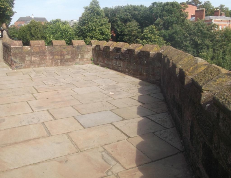
Tower at south-east corner of City Walls. Probably C13, damaged 1644-6 during the Civil War, converted to feature of the raised promenade of the wall walk 1702-8 and repaired during various periods. Coursed red sandstone rubble. The bastion forms a 3-sided projection from the wall, its platform level with the wall-walk. There is no evidence of any chamber beneath that level. There is mock-crenellation; the tower level and parapet were altered at the expense of Councillor Charles Brown 1879-80. The tower stands on an outcrop of red sandstone. (Cheshire Sites and Monuments Record: Collens J: Chester City: 3007/2/14; Improvement Committee Minutes: Chester City Council: 3/9/1879: 1879-).
Listing NGR: SJ4079465987
External links are from the relevant listing authority and, where applicable, Wikidata. Wikidata IDs may be related buildings as well as this specific building. If you want to add or update a link, you will need to do so by editing the Wikidata entry.


Other nearby listed buildings