Latitude: 52.8015 / 52°48'5"N
Longitude: -1.4574 / 1°27'26"W
OS Eastings: 436680
OS Northings: 322800
OS Grid: SK366228
Mapcode National: GBR 6GF.BCW
Mapcode Global: WHDHD.LV75
Plus Code: 9C4WRG2V+J3
Entry Name: Polygonal Animal Shelter
Listing Date: 6 January 1987
Grade: II
Source: Historic England
Source ID: 1376658
English Heritage Legacy ID: 82822
ID on this website: 101376658
Location: South Derbyshire, DE73
County: Derbyshire
District: South Derbyshire
Civil Parish: Calke
Traditional County: Derbyshire
Lieutenancy Area (Ceremonial County): Derbyshire
Church of England Parish: Ticknall St George
Church of England Diocese: Derby
Tagged with: Architectural structure
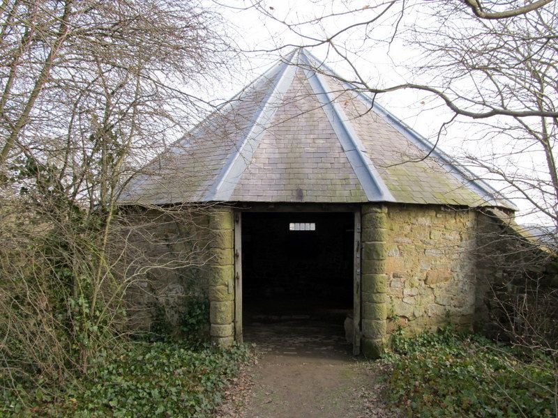
PARISH OF CALKE CALKE PARK
SK 32 SE
4/17
Polygonal Animal
Shelter
GV II
Animal shelter. Mid-C19. Rubble limestone and tooled
sandstone. Welsh slate roof. Polygonal in plan with twelve
sides, divided by circular engaged columns. One bay to west.
Three square window openings. Listed for group value only.
Listing NGR: SK3668022800
External links are from the relevant listing authority and, where applicable, Wikidata. Wikidata IDs may be related buildings as well as this specific building. If you want to add or update a link, you will need to do so by editing the Wikidata entry.


Other nearby listed buildings