Latitude: 51.5042 / 51°30'15"N
Longitude: -0.0915 / 0°5'29"W
OS Eastings: 532554
OS Northings: 180093
OS Grid: TQ325800
Mapcode National: GBR RG.LY
Mapcode Global: VHGR0.CGG6
Plus Code: 9C3XGW35+M9
Entry Name: 52 Borough High Street
Listing Date: 2 October 1990
Grade: II
Source: Historic England
Source ID: 1378351
English Heritage Legacy ID: 470650
ID on this website: 101378351
Location: The Borough, Southwark, London, SE1
County: London
District: Southwark
Electoral Ward/Division: Cathedrals
Parish: Non Civil Parish
Built-Up Area: Southwark
Traditional County: Surrey
Lieutenancy Area (Ceremonial County): Greater London
Church of England Parish: St Saviour with All Hallows Southwark
Church of England Diocese: Southwark
Tagged with: Building
This List entry was subject to a Minor Amendment on 31/08/2018
TQ 3280SE
636-1/17/83
SOUTHWARK
BOROUGH HIGH STREET (west side),
No.52
(Formerly listed as: No. 52A BOROUGH HIGH STREET)
02/10/90
GV
II
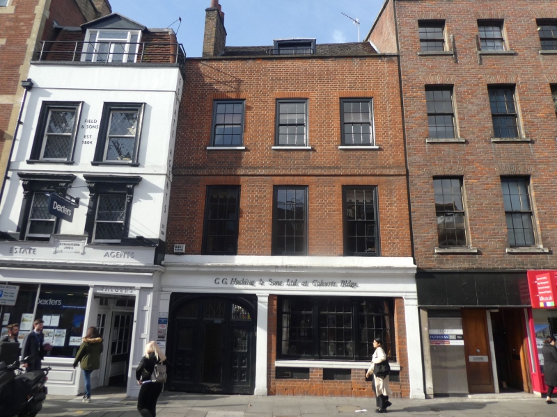
Warehouse. c1874. By R C Pope. Red brick in Flemish bond; stuccoed side elevation. Roof concealed by stone parapet. Two storeys; two ground-floor windows. Parapet has wide stone eaves cornice with brackets and large stylized acroteria to centre and sides. Brick dogtooth cornice immediately below. Ground floor has commercial shop front with four brick piers flanking two doorways with double panelled doors with rectangular fanlights above. Left-hand shop front has four mullioned and transomed fixed lights, all with engraved glass and stylized anthemions. Brick dog-tooth band at first floor level. Series of seven round-headed blank arches to first floor, with impost blocks and three aprons beneath.
INTERIOR: divided into wooden panelled rooms.
Has group value as probable part of a group of premises for hop factors situated opposite the Hop Exchange of 1866. (District Surveyors Returns MBW 1646. 22 July 1874).
Listing NGR: TQ3255480093
External links are from the relevant listing authority and, where applicable, Wikidata. Wikidata IDs may be related buildings as well as this specific building. If you want to add or update a link, you will need to do so by editing the Wikidata entry.


Other nearby listed buildings