Latitude: 51.559 / 51°33'32"N
Longitude: -0.1736 / 0°10'24"W
OS Eastings: 526708
OS Northings: 186042
OS Grid: TQ267860
Mapcode National: GBR D0.GWS
Mapcode Global: VHGQR.Y23N
Plus Code: 9C3XHR5G+JH
Entry Name: Railings to Footpath on North West Side
Listing Date: 14 May 1974
Grade: II
Source: Historic England
Source ID: 1379175
English Heritage Legacy ID: 478542
ID on this website: 101379175
Location: Vale of Health, Camden, London, NW3
County: London
District: Camden
Electoral Ward/Division: Hampstead Town
Parish: Non Civil Parish
Built-Up Area: Camden
Traditional County: Middlesex
Lieutenancy Area (Ceremonial County): Greater London
Church of England Parish: Christ Church Hampstead
Church of England Diocese: London
Tagged with: Guard rail
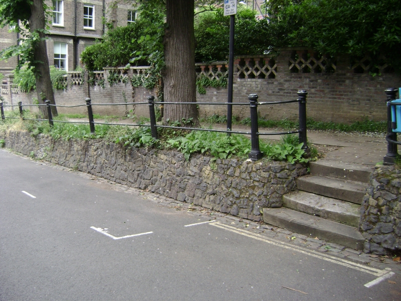
CAMDEN
TQ2686SE WELL WALK
798-1/17/1703 (North West side)
14/05/74 Railings to footpath on north west
side
GV II
Railings to raised footpath. C19. Cast-iron. Fluted column
standards with 2 round rails.
Listing NGR: TQ2670986042
External links are from the relevant listing authority and, where applicable, Wikidata. Wikidata IDs may be related buildings as well as this specific building. If you want to add or update a link, you will need to do so by editing the Wikidata entry.


Other nearby listed buildings