Approximate Location Map
Large Map »
Latitude: 51.2088 / 51°12'31"N
Longitude: -2.6463 / 2°38'46"W
OS Eastings: 354945
OS Northings: 145710
OS Grid: ST549457
Mapcode National: GBR MN.43CL
Mapcode Global: VH89S.2WV6
Plus Code: 9C3V6953+GF
Entry Name: 19 and 21, High Street
Listing Date: 12 November 1953
Grade: II
Source: Historic England
Source ID: 1382962
English Heritage Legacy ID: 483365
ID on this website: 101382962
Location: Wells, Somerset, BA5
County: Somerset
District: Mendip
Civil Parish: Wells
Built-Up Area: Wells
Traditional County: Somerset
Lieutenancy Area (Ceremonial County): Somerset
Tagged with: Building
WELLS
ST5445 HIGH STREET
662-1/7/95 (South side)
12/11/53 Nos.19 AND 21
GV II
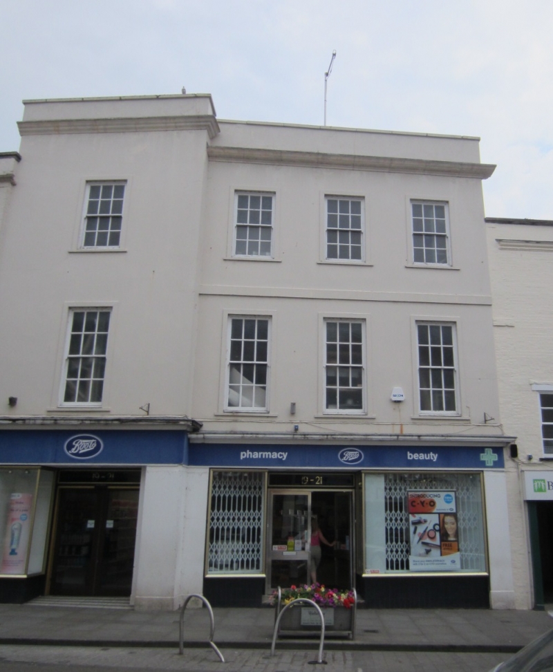
House with shop. c1800 facades to C20 building. Rendered and
colourwashed. Roof not visible behind parapet.
EXTERIOR: 3 storeys, 4 bays, of which bay 1 projects and
differs in detail. Band course between floors, bay 2 to 4
only, moulded cornice with plain parapet over. Later C20 shop
front in rendered surround, with pairs entrance doors bays 1
and 3, both in recesses, under deep fascia. Above, sash
windows in unmoulded architraves, all 12-pane, the panes of
the first floor long in proportion, to second floor almost
square.
INTERIOR: not inspected.
The c1800 facade is a significant feature in this important
streetscape.
Listing NGR: ST5494545710
External links are from the relevant listing authority and, where applicable, Wikidata. Wikidata IDs may be related buildings as well as this specific building. If you want to add or update a link, you will need to do so by editing the Wikidata entry.


Other nearby listed buildings
