Approximate Location Map
Large Map »
Latitude: 51.2083 / 51°12'29"N
Longitude: -2.6485 / 2°38'54"W
OS Eastings: 354795
OS Northings: 145655
OS Grid: ST547456
Mapcode National: GBR MN.42V1
Mapcode Global: VH89S.1WQL
Plus Code: 9C3V6952+8J
Entry Name: 66, High Street
Listing Date: 13 November 1996
Grade: II
Source: Historic England
Source ID: 1382995
English Heritage Legacy ID: 483412
ID on this website: 101382995
Location: Wells, Somerset, BA5
County: Somerset
District: Mendip
Civil Parish: Wells
Built-Up Area: Wells
Traditional County: Somerset
Lieutenancy Area (Ceremonial County): Somerset
Tagged with: Building
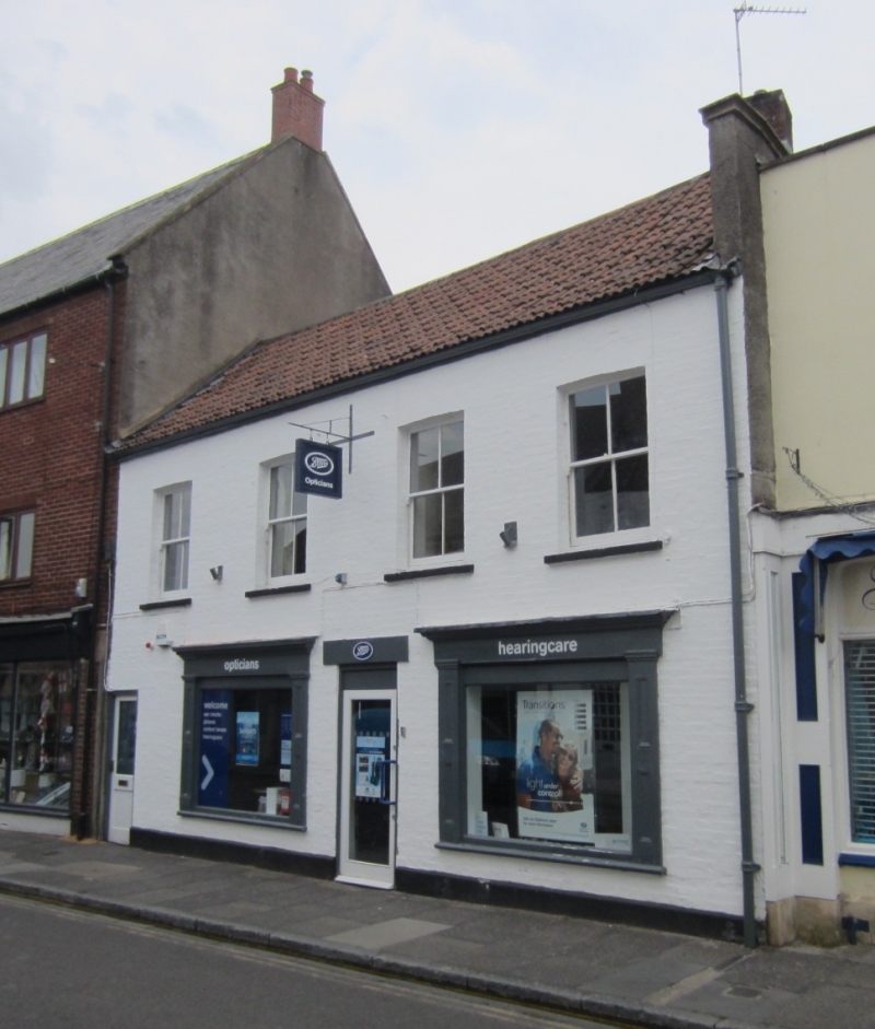
WELLS
ST5445 HIGH STREET
662-1/7/132 (North side)
13/11/96 No.66
GV II
House in row, with shop. Early C17; C18 or C19 front. Painted
brick front, but stonework in some inner walls, double Roman
tile roof, brick stack.
EXTERIOR: 2 storeys, 4 bays; at first floor are 4-pane sashes,
and ground floor has a throughway to the left, and shop-front
with 2 wide panelled pilasters central doorway and moulded
cornice. Small stack, right.
INTERIOR: the ground floor only was accessible. This has a
front room with very low ceiling, early features concealed,
and a rear room with higher ceiling, and one early C17
chamfered and stopped transverse beam; it seems likely that
others may be concealed.
The property needs further investigation.
Listing NGR: ST5479545655
External links are from the relevant listing authority and, where applicable, Wikidata. Wikidata IDs may be related buildings as well as this specific building. If you want to add or update a link, you will need to do so by editing the Wikidata entry.


Other nearby listed buildings
