Approximate Location Map
Large Map »
Latitude: 52.538 / 52°32'16"N
Longitude: -2.8085 / 2°48'30"W
OS Eastings: 345256
OS Northings: 293660
OS Grid: SO452936
Mapcode National: GBR BG.F77P
Mapcode Global: VH75V.8GLP
Plus Code: 9C4VG5QR+6H
Entry Name: Memorial 15 Metres South of Chancel of Church of St Lawrence
Listing Date: 29 February 2000
Grade: II
Source: Historic England
Source ID: 1383276
English Heritage Legacy ID: 483694
ID on this website: 101383276
Location: St Laurence's Church, Church Stretton, Shropshire, SY6
County: Shropshire
Civil Parish: Church Stretton
Built-Up Area: Church Stretton
Traditional County: Shropshire
Lieutenancy Area (Ceremonial County): Shropshire
Church of England Parish: Church Stretton
Church of England Diocese: Hereford
Tagged with: Pedestal tomb
CHURCH STRETTON
SO4593 CHURCH STREET
1312-1/13/47 (East side)
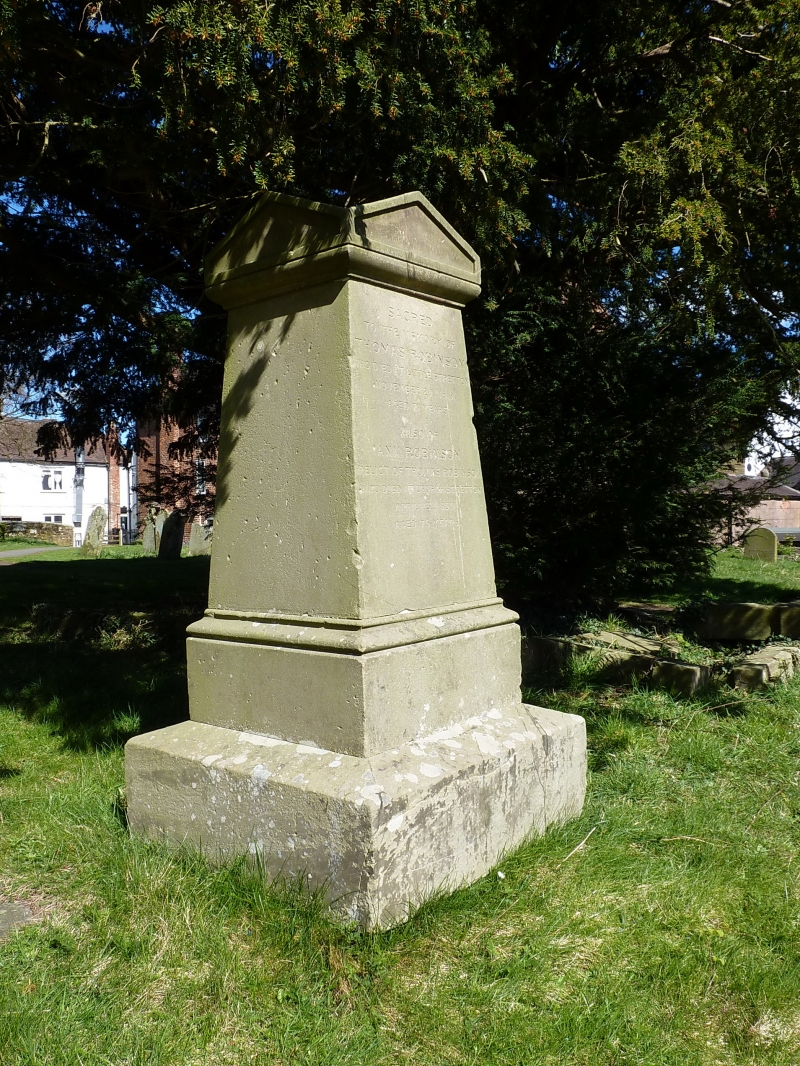
Memorial 15 metres south of chancel
of Church of St Lawrence
GV II
Pedestal tomb. Early C19. Sandstone ashlar. Pyramid cap with
pedimented cross gabled sides. Tapered solid shaft set on
moulded base. Plain weathered plinth. Commemorates Thomas
Robinson d.1819 and his wife Ann d.1830.
Listing NGR: SO4525693660
External links are from the relevant listing authority and, where applicable, Wikidata. Wikidata IDs may be related buildings as well as this specific building. If you want to add or update a link, you will need to do so by editing the Wikidata entry.


Other nearby listed buildings
