Approximate Location Map
Large Map »
Latitude: 52.538 / 52°32'16"N
Longitude: -2.8088 / 2°48'31"W
OS Eastings: 345240
OS Northings: 293659
OS Grid: SO452936
Mapcode National: GBR BG.F75H
Mapcode Global: VH75V.8GGP
Plus Code: 9C4VG5QR+6F
Entry Name: Sundial 2 Metres South of South Transept of Church of St Lawrence
Listing Date: 29 February 2000
Grade: II
Source: Historic England
Source ID: 1383280
English Heritage Legacy ID: 483698
ID on this website: 101383280
Location: St Laurence's Church, Cunnery, Shropshire, SY6
County: Shropshire
Civil Parish: Church Stretton
Built-Up Area: Church Stretton
Traditional County: Shropshire
Lieutenancy Area (Ceremonial County): Shropshire
Church of England Parish: Church Stretton
Church of England Diocese: Hereford
Tagged with: Sundial Churchyard cross
CHURCH STRETTON
SO4593 CHURCH STREET
1312-1/13/61 (East side)
Sundial 2 metres south of south
transept of Church of St Lawrence
GV II
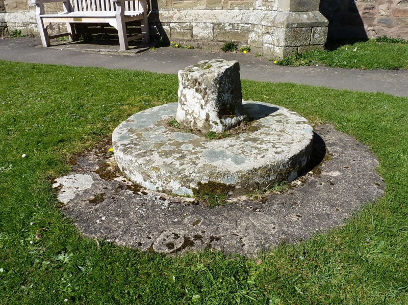
Churchyard cross now sundial. Medieval, C18 and early C19.
Sandstone ashlar. Former shaft head of churchyard cross
converted to sundial.
Shaft with carved cap and band below head and with traces of
recessed carved ornament on shaft. Shaft set at the junction
of the arms (now missing) of the former cross and is set into
circular base made of former mill wheel. Mill wheel with
initials T.W. and I.W. recorded as churchwardens in 1713.
Brass dial overlaid with later replacement now with gnomon
missing.
Older plate has inscription: `Richard Beddoes, Thomas Haines,
Churchwardens 1824'.
Listing NGR: SO4524093659
External links are from the relevant listing authority and, where applicable, Wikidata. Wikidata IDs may be related buildings as well as this specific building. If you want to add or update a link, you will need to do so by editing the Wikidata entry.


Other nearby listed buildings
