Approximate Location Map
Large Map »
Latitude: 52.3154 / 52°18'55"N
Longitude: -2.5969 / 2°35'48"W
OS Eastings: 359403
OS Northings: 268750
OS Grid: SO594687
Mapcode National: GBR BQ.WCC9
Mapcode Global: VH84K.X2YC
Plus Code: 9C4V8C83+46
Entry Name: Milepost at Ngr So 5940 6872
Listing Date: 29 February 2000
Grade: II
Source: Historic England
Source ID: 1383424
English Heritage Legacy ID: 483842
ID on this website: 101383424
Location: Burford, Shropshire, WR15
County: Shropshire
Civil Parish: Burford
Built-Up Area: Tenbury Wells
Traditional County: Shropshire
Lieutenancy Area (Ceremonial County): Shropshire
Church of England Parish: Burford, 3rd Portion
Church of England Diocese: Hereford
Tagged with: Milestone
BURFORD
SO56NE A 456
582-1/8/16 (North side)
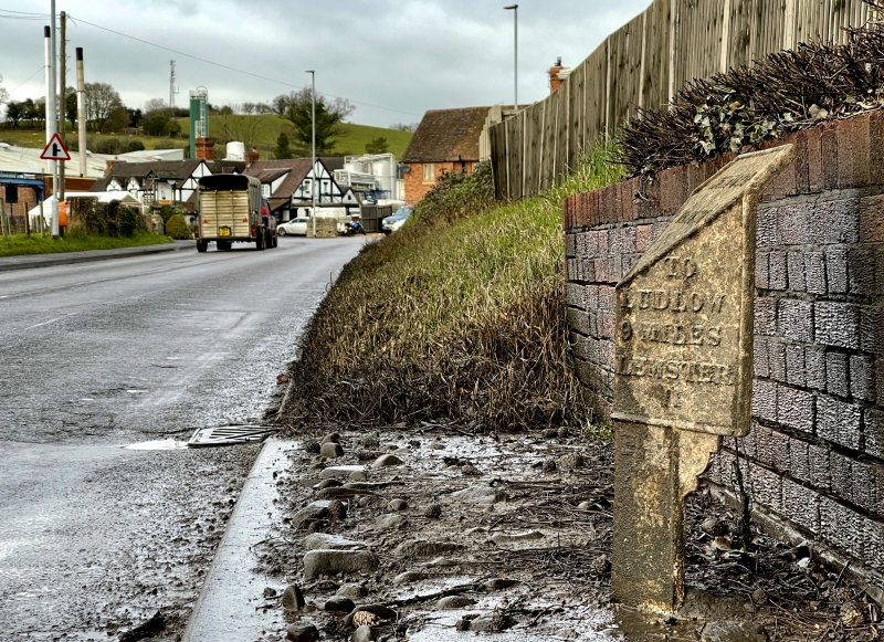
Milepost at NGR SO 5940 6872
II
Milepost. Early C19. Cast-iron. 2 angled name-plates with
sloping connecting top plate. Angle-section support post with
curved brackets. Raised edges and lettering. Destination
plates: TO TENBURY 1/4 MILE; TO LUDLOW 9 MILES; LEMSTER 11.
Top plate: BURFORD PARISH.
Listing NGR: SO5940368749
External links are from the relevant listing authority and, where applicable, Wikidata. Wikidata IDs may be related buildings as well as this specific building. If you want to add or update a link, you will need to do so by editing the Wikidata entry.


Other nearby listed buildings
