Approximate Location Map
Large Map »
Latitude: 52.3786 / 52°22'43"N
Longitude: -2.4807 / 2°28'50"W
OS Eastings: 367373
OS Northings: 275729
OS Grid: SO673757
Mapcode National: GBR BW.R9YZ
Mapcode Global: VH847.YGDX
Plus Code: 9C4V9GH9+CP
Entry Name: The Vicarage
Listing Date: 12 November 1954
Grade: II*
Source: Historic England
Source ID: 1383441
English Heritage Legacy ID: 483859
ID on this website: 101383441
Location: Cleobury Mortimer, Shropshire, DY14
County: Shropshire
Civil Parish: Cleobury Mortimer
Built-Up Area: Cleobury Mortimer
Traditional County: Shropshire
Lieutenancy Area (Ceremonial County): Shropshire
Church of England Parish: Cleobury Mortimer
Church of England Diocese: Hereford
Tagged with: Clergy house
CLEOBURY MORTIMER
SO6775 CHURCH STREET
582-1/13/35 (South side)
12/11/54 No.3
The Vicarage
GV II*
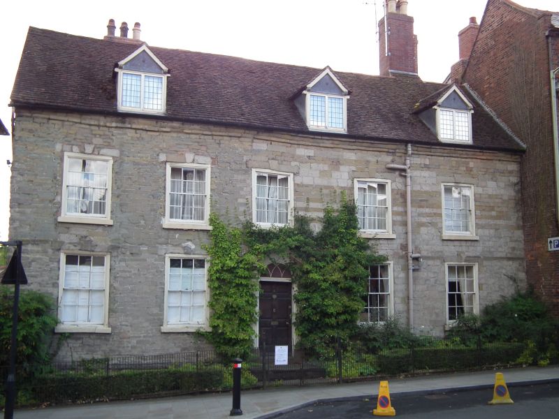
Vicarage, now house. Early C18 with C19 additions, and C20
alterations. Ashlar and stone rubble, with moulded stone
eaves, set on stone plinth with chamfered ashlar capping.
Plain-tile roof. Projecting brick gable-end stacks to rear,
and ridge stack to right. Front range with gabled rear wings.
EXTERIOR: 2 storeys, attic and cellar. 2-storey, 5-window
range with 6/6 sashes with moulded cases, stone sills,
keystones and stone lintels. Central doorcase with fluted
pilasters, open bed pediment incorporating re-entrant fanlight
with intersecting tracery glazing bars and 6 panelled door. 3
tiled gabled dormers with leaded 2-light casements.
Rear: stone rubble gable to right (east) with brick projecting
gable-end stack. Partly covered by brick tiled gabled C19
extension wings.
INTERIOR: not inspected.
Listing NGR: SO6737175728
External links are from the relevant listing authority and, where applicable, Wikidata. Wikidata IDs may be related buildings as well as this specific building. If you want to add or update a link, you will need to do so by editing the Wikidata entry.


Other nearby listed buildings
