Approximate Location Map
Large Map »
Latitude: 54.3281 / 54°19'41"N
Longitude: -2.3183 / 2°19'6"W
OS Eastings: 379393
OS Northings: 492548
OS Grid: SD793925
Mapcode National: GBR DL7D.W8
Mapcode Global: WH947.CG8W
Plus Code: 9C6V8MHJ+6M
Entry Name: Railway Bridge Approximately 200 Metres North of Dandrymire Viaduct
Listing Date: 18 October 1999
Grade: II
Source: Historic England
Source ID: 1384059
English Heritage Legacy ID: 484491
ID on this website: 101384059
Location: Westmorland and Furness, Cumbria, LA10
County: Cumbria
District: South Lakeland
Civil Parish: Garsdale
Traditional County: Yorkshire
Lieutenancy Area (Ceremonial County): North Yorkshire
Church of England Parish: Sedbergh, Cautley and Garsdale
Church of England Diocese: Carlisle
Tagged with: Railway bridge
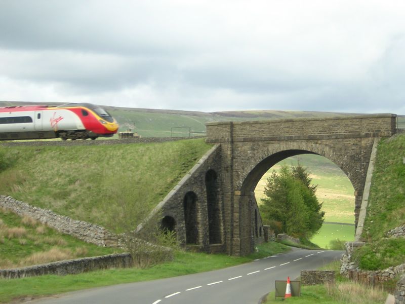
GARSDALE
SD79SE HAWES ROAD, Garsdale Head
162-1/8/268 Railway Bridge approx. 200m north of
Dandrymire Viaduct
GV II
Railway bridge carrying Settle to Carlisle railway over Hawes
Road. 1869-75, for the Midland Railway Company; company
architect JH Sanders, chief engineer JS Crossly, resident
engineer J Underwood. Coursed sandstone rubble. Segmental arch
with impost bands carried through, rubble voussoirs, terminal
piers, string-course and parapets with flat coping. Sloped and
battered abutments with segmental-headed blank arches. Forms
part of raised structure comprised of the Dandrymire Viaduct
approx. 200m south (qv) and raised embankment to which the
bridge is attached.
Listing NGR: SD7939392548
External links are from the relevant listing authority and, where applicable, Wikidata. Wikidata IDs may be related buildings as well as this specific building. If you want to add or update a link, you will need to do so by editing the Wikidata entry.


Other nearby listed buildings
