Approximate Location Map
Large Map »
Latitude: 51.4643 / 51°27'51"N
Longitude: -0.0527 / 0°3'9"W
OS Eastings: 535364
OS Northings: 175724
OS Grid: TQ353757
Mapcode National: GBR JD.HCG
Mapcode Global: VHGR7.1GG9
Plus Code: 9C3XFW7W+PW
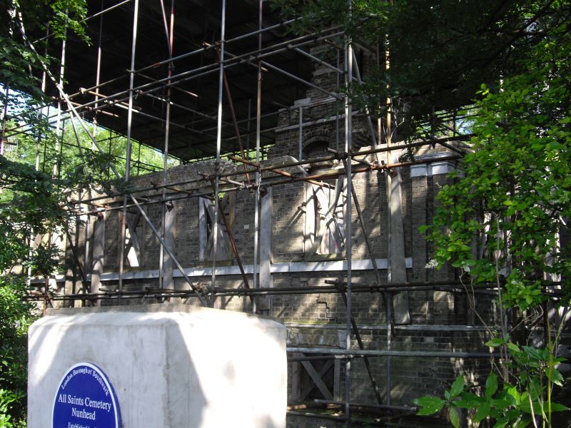
Entry Name: East Lodge, Nunhead Cemetery
Listing Date: 27 September 1972
Last Amended: 17 September 1998
Grade: II
Source: Historic England
Source ID: 1385647
English Heritage Legacy ID: 471051
ID on this website: 101385647
Location: Nunhead Cemetery, Nunhead, Southwark, London, SE15
County: London
District: Southwark
Electoral Ward/Division: Nunhead
Parish: Non Civil Parish
Built-Up Area: Southwark
Traditional County: Surrey
Lieutenancy Area (Ceremonial County): Greater London
Church of England Parish: Nunhead St Antony with St Silas
Church of England Diocese: Southwark
Tagged with: Architectural structure
TQ3575NW
636-1/50/472
27/09/72
SOUTHWARK
LINDEN GROVE(South East side)East Lodge, Nunhead Cemetery(Formerly Listed as:LINDEN GROVE two entrance lodges to Nunhead Cemetery)
GII
Cemetery lodge.C1840.By James Bunning.For the London Cemetery Company.Stock brick with stone roof(not visible).Single storey over basement.Square plan with three-window ranges to side and rear elevations,and one window to either side of central porch,front elevation.A full-height extension,now roofless,with a two-window range to the south and a bay window to the north,both of a later date.Built as a pair with West Lodge(qv),to right of gates.
Listing NGR: TQ3536475724
External links are from the relevant listing authority and, where applicable, Wikidata. Wikidata IDs may be related buildings as well as this specific building. If you want to add or update a link, you will need to do so by editing the Wikidata entry.


Other nearby listed buildings
