Latitude: 51.4893 / 51°29'21"N
Longitude: -0.0636 / 0°3'49"W
OS Eastings: 534535
OS Northings: 178487
OS Grid: TQ345784
Mapcode National: GBR YN.V9
Mapcode Global: VHGR0.VT7N
Plus Code: 9C3XFWQP+PH
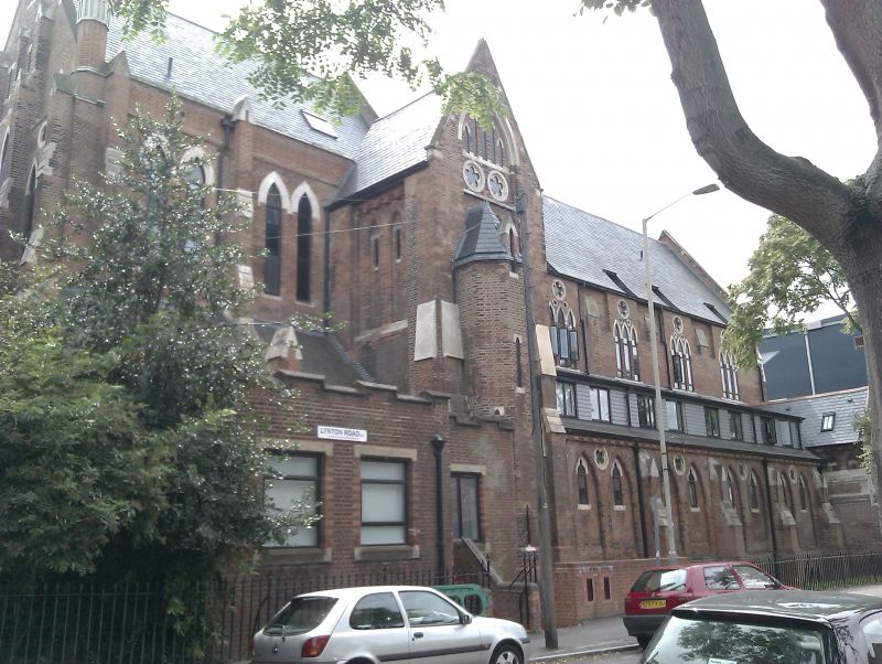
Entry Name: Church of St Augustine
Listing Date: 27 September 1972
Grade: II*
Source: Historic England
Source ID: 1385687
English Heritage Legacy ID: 471091
Also known as: St Augustine's Church, Bermondsey
ID on this website: 101385687
Location: Southwark, London, SE1
County: London
District: Southwark
Electoral Ward/Division: South Bermondsey
Parish: Non Civil Parish
Built-Up Area: Southwark
Traditional County: Surrey
Lieutenancy Area (Ceremonial County): Greater London
Church of England Parish: Bermondsey St Anne and St Augustine
Church of England Diocese: Southwark
Tagged with: Church building
SOUTHWARK
TQ3478SE LYNTON ROAD 636-1/29/510 (South side) 27/09/72 Church of St Augustine
GV II*
Church. 1875-1878, west end 1882-3. By Henry Jarvis and Son, architects; vestries added 1907 by Hesketh & Stokes. MATERIALS: red brick with stone dressings and pitched slate roof. STYLE: Early English. PLAN: Lofty 5-bay nave with clerestory, aisles and straight-ended ambulatory to 3-bay chancel; concrete vaulted undercroft. North extension of 1 bay at crossing and gabled porch to west end of north aisle. EXTERIOR: east tower designed but never built. Large west window with tiers of lancets, rose window in gable; entrances to centre and right below. Ground-floor windows double lancets with 5-light grouped lancets inside. Plate-traceried clerestory windows with groups of 3 lancets, 2-light openings inside. INTERIOR: has richly moulded arches to nave on figure-8 shaped sandstone piers with carved leaf capitals, clerestory windows behind arcade above string course. Slightly higher vaulted chancel with stone ribs and brick panels. North organ chamber and south chapel. Church established in poor area by Richard Foster.
Listing NGR: TQ3453578487
External links are from the relevant listing authority and, where applicable, Wikidata. Wikidata IDs may be related buildings as well as this specific building. If you want to add or update a link, you will need to do so by editing the Wikidata entry.


Other nearby listed buildings