Approximate Location Map
Large Map »
Latitude: 51.5069 / 51°30'24"N
Longitude: -0.1078 / 0°6'27"W
OS Eastings: 531420
OS Northings: 180363
OS Grid: TQ314803
Mapcode National: GBR MF.YZ
Mapcode Global: VHGR0.2DW4
Plus Code: 9C3XGV4R+QV
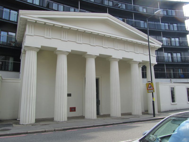
Entry Name: Portico of Unitarian Chapel
Listing Date: 2 March 1950
Grade: II
Source: Historic England
Source ID: 1385935
English Heritage Legacy ID: 471355
ID on this website: 101385935
Location: North Southwark, Lambeth, London, SE1
County: London
District: Lambeth
Electoral Ward/Division: Bishop's
Parish: Non Civil Parish
Built-Up Area: Lambeth
Traditional County: Surrey
Lieutenancy Area (Ceremonial County): Greater London
Church of England Parish: Southwark Christ Church
Church of England Diocese: Southwark
Tagged with: Chapel
SOUTHWARK
TQ3180 STAMFORD STREET
636-1/1/885 (South side)
02/03/50 Portico of Unitarian Chapel
II
Large portico and part of ground floor. 1821. Doric hexastyle
portico with triglyph frieze and pediment over. Central door
with shouldered architrave and iron gates. Remaining ground
floor walls at either side, each with 3 blank windows with
shouldered architraves. Remainder of Unitarian Chapel now
demolished.
Listing NGR: TQ3142580350
External links are from the relevant listing authority and, where applicable, Wikidata. Wikidata IDs may be related buildings as well as this specific building. If you want to add or update a link, you will need to do so by editing the Wikidata entry.


Other nearby listed buildings
