Approximate Location Map
Large Map »
Latitude: 51.4956 / 51°29'44"N
Longitude: -0.0326 / 0°1'57"W
OS Eastings: 536669
OS Northings: 179240
OS Grid: TQ366792
Mapcode National: GBR K5.GFQ
Mapcode Global: VHGR1.DN3V
Plus Code: 9C3XFXW8+6X
Entry Name: Tide Gauge House on South Quay of Greenland Lock
Listing Date: 1 July 1983
Last Amended: 17 September 1998
Grade: II
Source: Historic England
Source ID: 1385947
English Heritage Legacy ID: 471367
ID on this website: 101385947
Location: Tavern Quay, Southwark, London, SE16
County: London
District: Southwark
Electoral Ward/Division: Surrey Docks
Parish: Non Civil Parish
Built-Up Area: Southwark
Traditional County: Surrey
Lieutenancy Area (Ceremonial County): Greater London
Church of England Parish: Rotherhithe Holy Trinity
Church of England Diocese: Southwark
Tagged with: Architectural structure
TQ3679SE
636-1/25/753
01/07/83
SOUTHWARK
SURREY DOCKS
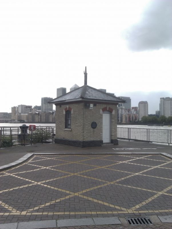
Tide Gauge House on south quay of Greenland Lock
(Formerly Listed as:
SURREY DOCKS
Guard House on south quay of Greenland Lock)
GV
II
Tide gauge house. c1880-90. Stock brick walls on black brick
plinth, red brick window arches with stucco imposts and keys
and similar doorcase. Pyramidal slate roof with flat eaves and
finial chimney. One storey, one window on square plan.
INTERIOR: not inspected.
Plaque records that the building housed a tide gauge which
indicated the height of the water in the river. Erroneously
formerly listed as a guard house.
Listing NGR: TQ3666979240
External links are from the relevant listing authority and, where applicable, Wikidata. Wikidata IDs may be related buildings as well as this specific building. If you want to add or update a link, you will need to do so by editing the Wikidata entry.


Other nearby listed buildings
