Latitude: 53.4839 / 53°29'2"N
Longitude: -2.3026 / 2°18'9"W
OS Eastings: 380013
OS Northings: 398621
OS Grid: SJ800986
Mapcode National: GBR D4G.43
Mapcode Global: WH989.LPQJ
Plus Code: 9C5VFMMW+HW
Entry Name: Church of St Luke
Listing Date: 18 January 1980
Grade: II*
Source: Historic England
Source ID: 1386145
English Heritage Legacy ID: 471569
Also known as: Church of St Luke with All Saints, Weaste
ID on this website: 101386145
Location: St Luke's Church, Seedley, Salford, Greater Manchester, M6
County: Salford
Electoral Ward/Division: Weaste and Seedley
Parish: Non Civil Parish
Built-Up Area: Salford
Traditional County: Lancashire
Lieutenancy Area (Ceremonial County): Greater Manchester
Church of England Parish: Weaste, Seedley and Langworthy
Church of England Diocese: Manchester
Tagged with: Church building
SALFORD
SJ89NW LIVERPOOL STREET 949-1/4/70 (South side) 18/01/80 Church of St Luke
II*
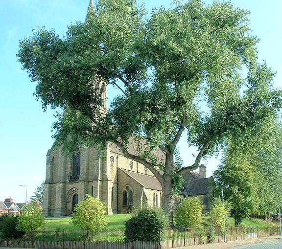
Parish church. 1865, the chancel chapel added 1875. By George Gilbert Scott. Coursed sandstone rubble with plain-tiled roof. Gothic style with nave with clerestory and aisles. EXTERIOR: lower chancel with semicircular apse and attached chapels to N and S with parallel ridges and end gables. Projecting gabled porch to N. Slim tower over W end with angle buttresses and bell chamber lights with paired lancets. Brooch spire above with lucarnes. Nave of 4 bays, with paired lancets to aisles with foiled circular windows to clerestory. Paired lancets between buttresses to apse, and similar to side chapels but with plate tracery. Stone plinth with continuous sill-band. INTERIOR: quatrefoil piers to arcade, and apse with arcading alternating stained glass windows by Kempe and painted panels over panelled dado. East window possibly by Hardman. Tower supported internally by large circular columns with carved capitals. (The Buildings of England: Pevsner N: South Lancashire: Harmondsworth: 1969-: 395).
Listing NGR: SJ8001398621
External links are from the relevant listing authority and, where applicable, Wikidata. Wikidata IDs may be related buildings as well as this specific building. If you want to add or update a link, you will need to do so by editing the Wikidata entry.


Other nearby listed buildings