The listing was removed on 10 May 2022.
This building has been assessed for de-listing under the Planning (Listed Buildings and Conservation Areas) Act 1990 as amended. The building has been removed from The National Heritage List for England as it no longer meets the criteria for listing.
The information below has been retained for archive purposes. It does not necessarily reflect the current state of the building.
Latitude: 52.1045 / 52°6'16"N
Longitude: -2.071 / 2°4'15"W
OS Eastings: 395232
OS Northings: 245135
OS Grid: SO952451
Mapcode National: GBR 2JT.56Q
Mapcode Global: VHB0R.1CZH
Plus Code: 9C4V4W3H+RH
Entry Name: Pershore Bridge, South Bridge (That Part in Wick Civil Parish)
Listing Date: 3 August 1972
Last Amended: 27 April 1999
Delisted Date: 10 May 2022
Grade: II
Source: Historic England
Source ID: 1386749
English Heritage Legacy ID: 474145
Also known as: Pershore Bridge - South Bridge
ID on this website: 101386749
Location: Pershore, Wychavon, Worcestershire, WR10
County: Worcestershire
District: Wychavon
Civil Parish: Pershore
Built-Up Area: Pershore
Traditional County: Worcestershire
Lieutenancy Area (Ceremonial County): Worcestershire
Church of England Parish: Pershore
Church of England Diocese: Worcester
Tagged with: Bridge
WICK
SO 9545
648/5/10011
Pershore Bridge - south bridge (that part in Wick CP)
3.8.72
GV II
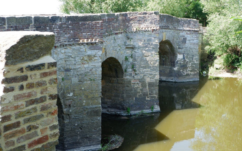
Bridge. Probably mid-Late C18, remodelled C20. Red brick, mostly in English garden wall bond. Hump-backed, having 2 segmental arches with gauged brick voussoirs reinforced with concrete. String course at base of parapet and part-cambered stone coping with end-piers. See also Pershore CP.
Listing NGR: SO9523245135
External links are from the relevant listing authority and, where applicable, Wikidata. Wikidata IDs may be related buildings as well as this specific building. If you want to add or update a link, you will need to do so by editing the Wikidata entry.


Other nearby listed buildings